
3.2 miles/hex map of Karameikos
by Giampaolo AgostaTo try out Isomage's hexgimp script, I've drawn a 3.2 miles/hex map of Karameikos.
It's not especially beautiful (hexgimp is good, but it's easy for me to mess up, and it takes a lot of time to place the hexes), but it gives an overview of which regions of Karameikos have been mapped out in greater detail.
I've reported locations (mostly villages and towns, plus the keeps and some famous ruins) and terrain from the following sources:
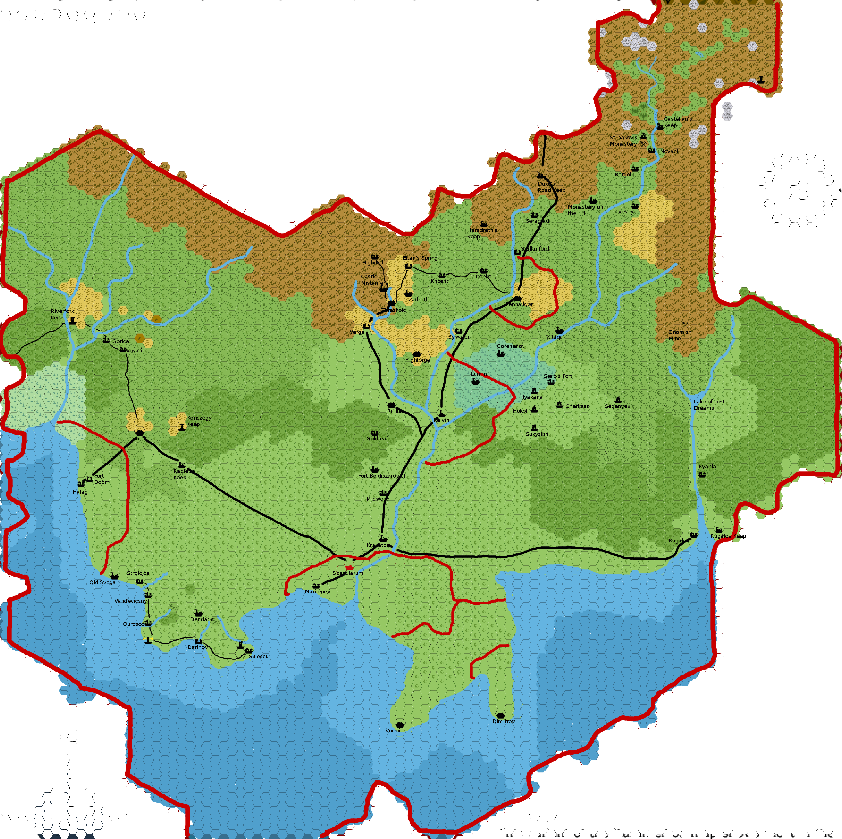
- The Gazetteer
- The B10, B11, and B12 adventures
- Zendrolion's Altan Tepee Gazetteer
- Zendrolion's map of north-central Karameikos (my variant version, though, with no Journey to the Rock stuff)
- My own Cry Wolf! and River of Blood adventures.
Another version of the same map, marking the areas of control of humans and non-humans.
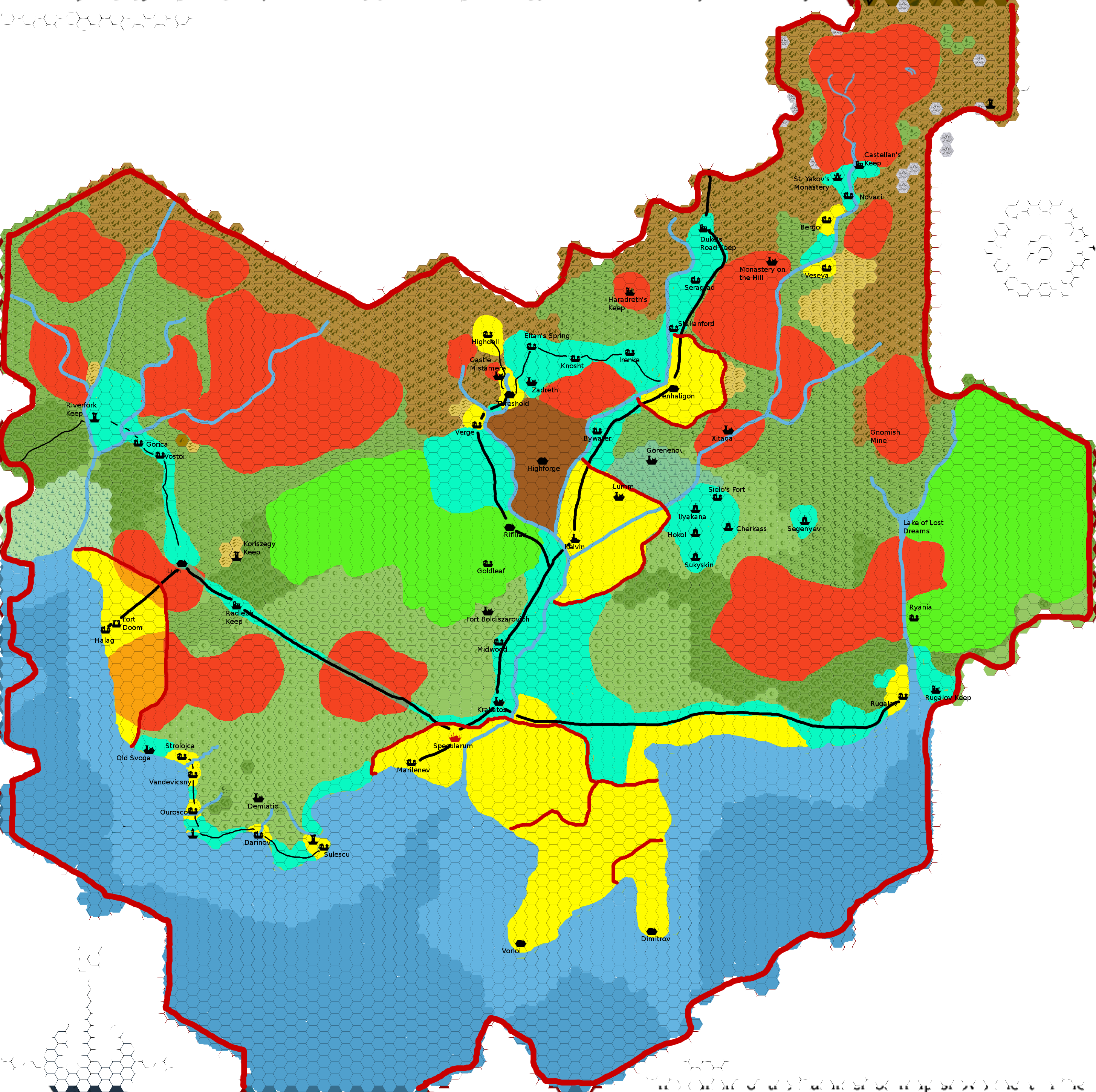
Colour code:
- Yellow: lands controlled by the various lesser nobles (including Stefan or Adriana Karameikos as Lord/Lady of Specularum).
- Cyan: lands mainly inhabited by humans, but not part of fiefs.
- Green: elven lands (there may be Callarii elves south of Kelvin, but I've left this as a "contended" area).
- Brown: gnomish Kingdom of Highforge.
- Red: various goblinoid tribes.
Superimposed colours:
- Red and Yellow: the Black Eagle uses Goblinoid mercenaries to retain control of the human population of these areas.
- Red and Cyan: the troops of Radlebb Keep contend control of the Westron Road to the Bugbear tribes.
Non-coloured: areas controlled by other non-humans (e.g., Centaurs and Chevalls in the Moor and surrounding hills, Count Koriszegy in the area around Koriszegy Keep, dragons, the Beast of Radlebb), or contended/unpopulated lands. In many cases, these are buffer zones between enemy groups (e.g., Ogres and Callarii Elves north-west of Radlebb), in others, just lands that are not yet settled.