
Animated Savage Baronies Historical Map
by David TauriainenI finally completed the animated history map that I mentioned here
I started a project recently: A set of maps (or an animated image) which details the rise and fall of the Baronies in the short century of Espan/Ispan rule on the Savage Coast.
I'd been making images by modifying Ironwolf/Adamantyr's map of the Savage Baronies[...]
I decided against using the extended Rio Copos. Of course now that I've gotten this far, I've got an itch to make a version with towns and borders instead of colored political overlays.
The biggest assumption was that Hule hadn't been on the Gulf of Hule since the days of the Nithian Empire (otherwise, why wouldn't Hule have already settled around the gulf). Perhaps it was having enough trouble with northern barbarians up until 900AC. Making Hule expand into the region just as the Baronies were growing made the conquering of Babosas seem more realistic. The only problem is why would people call it the "Gulf of Hule" unless Hule was the common name of the area, and the Hagiarchy was named after the area instead of the other way around. Or maybe since Hule once extended down to the gulf, all the natives still call it by the name.
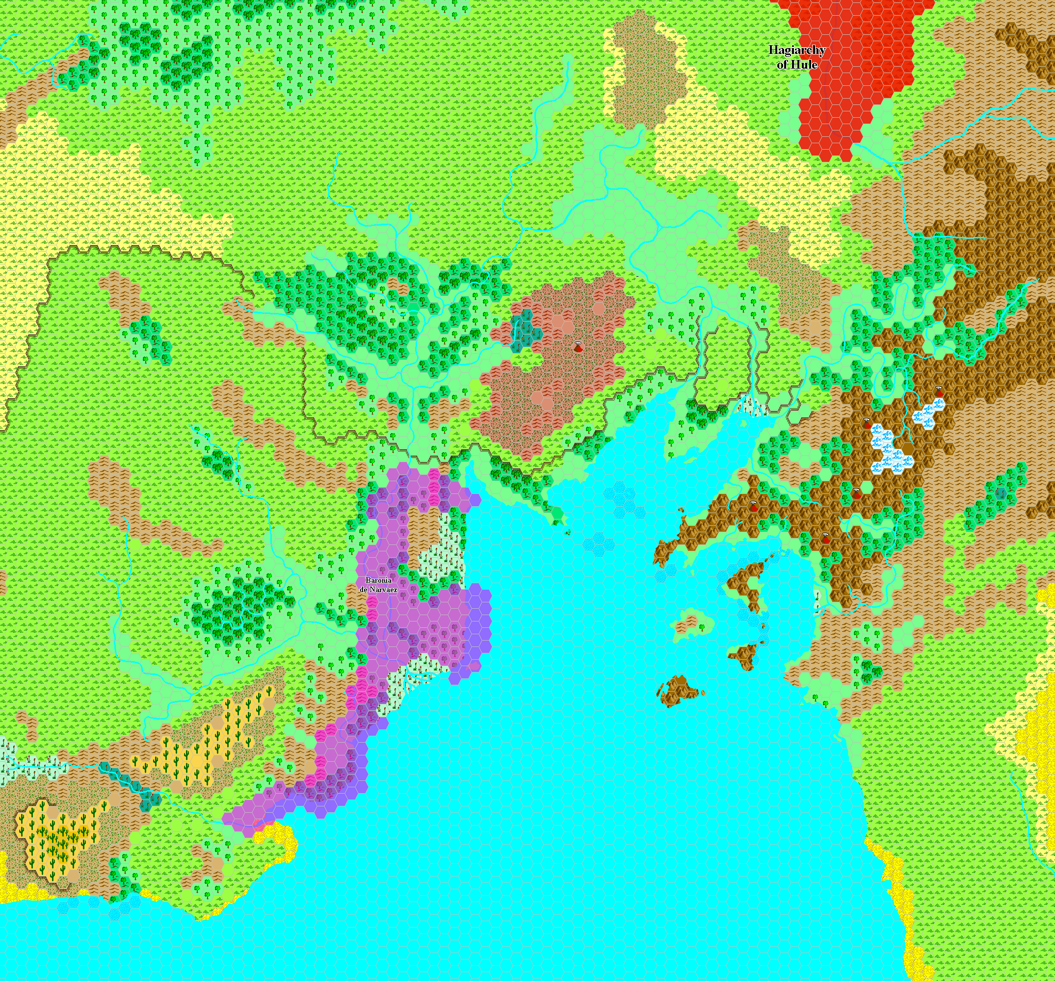
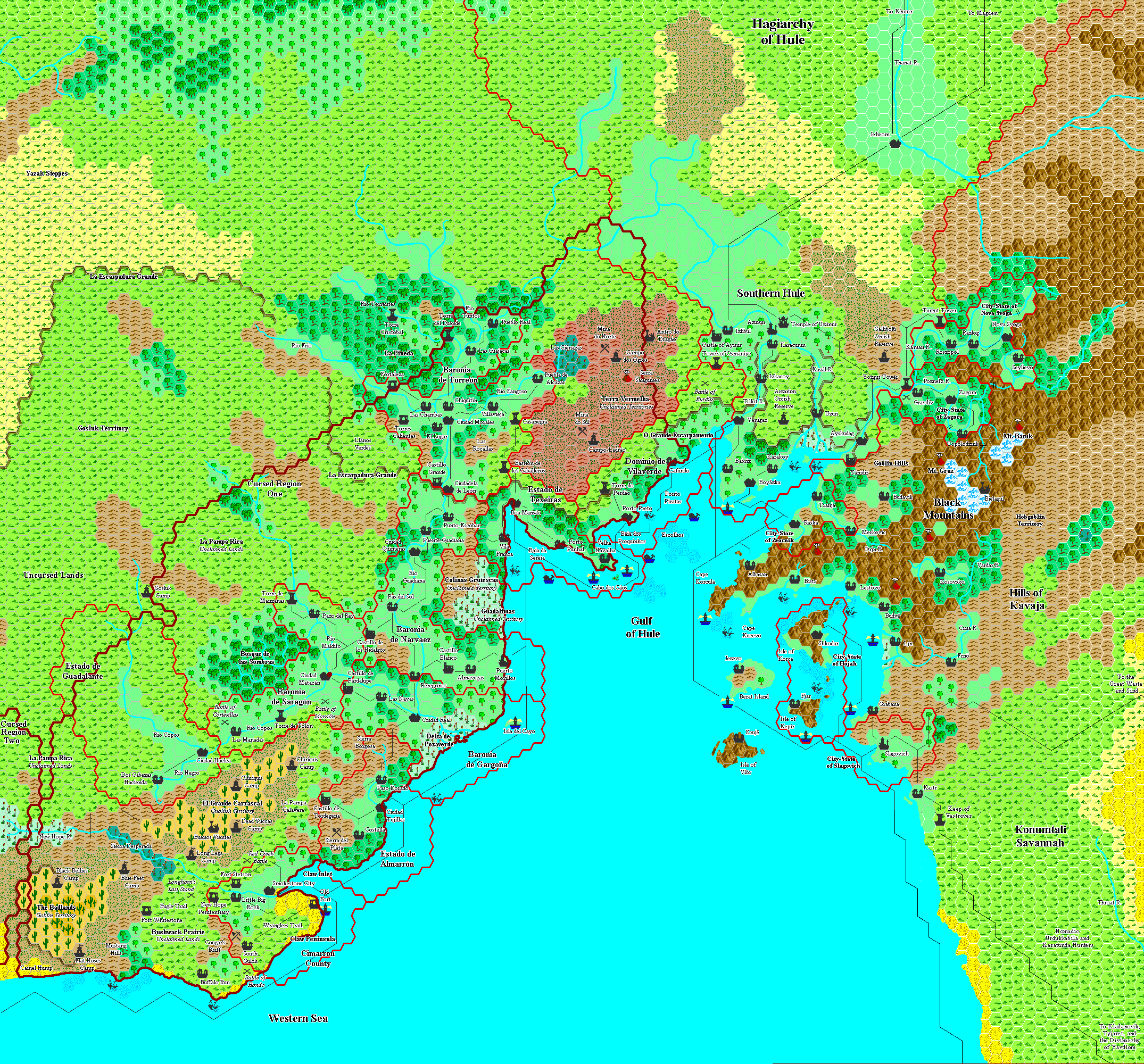
Here is a single image version of the last frame using Ironwolf/Adamantyr's art