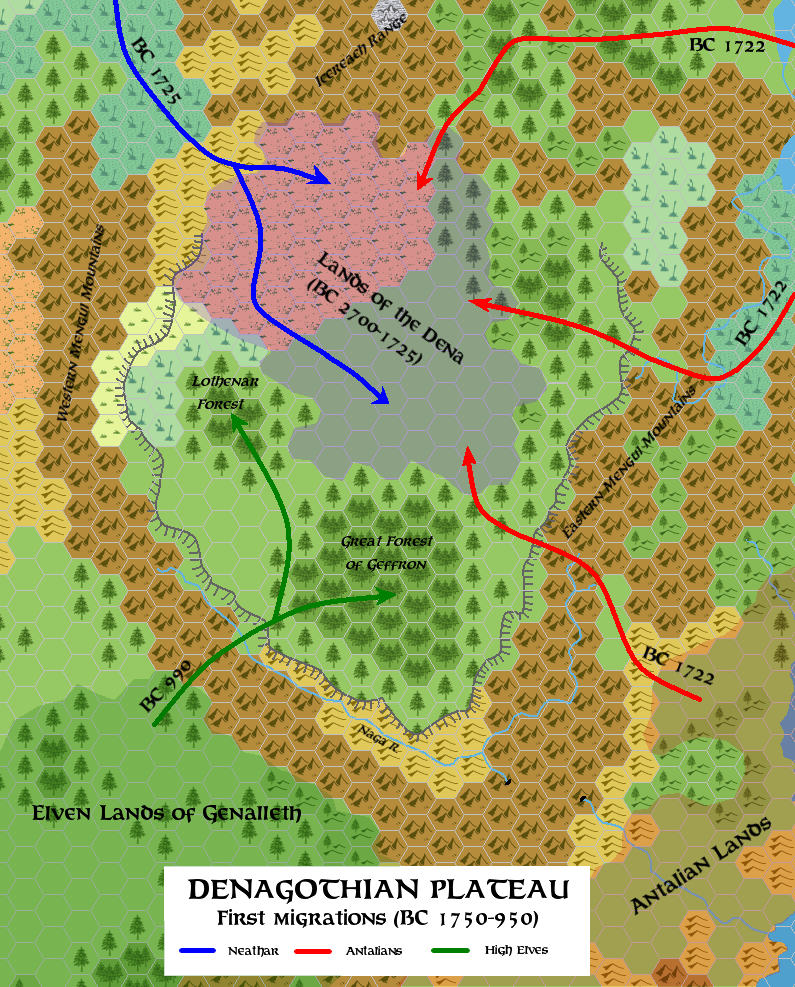
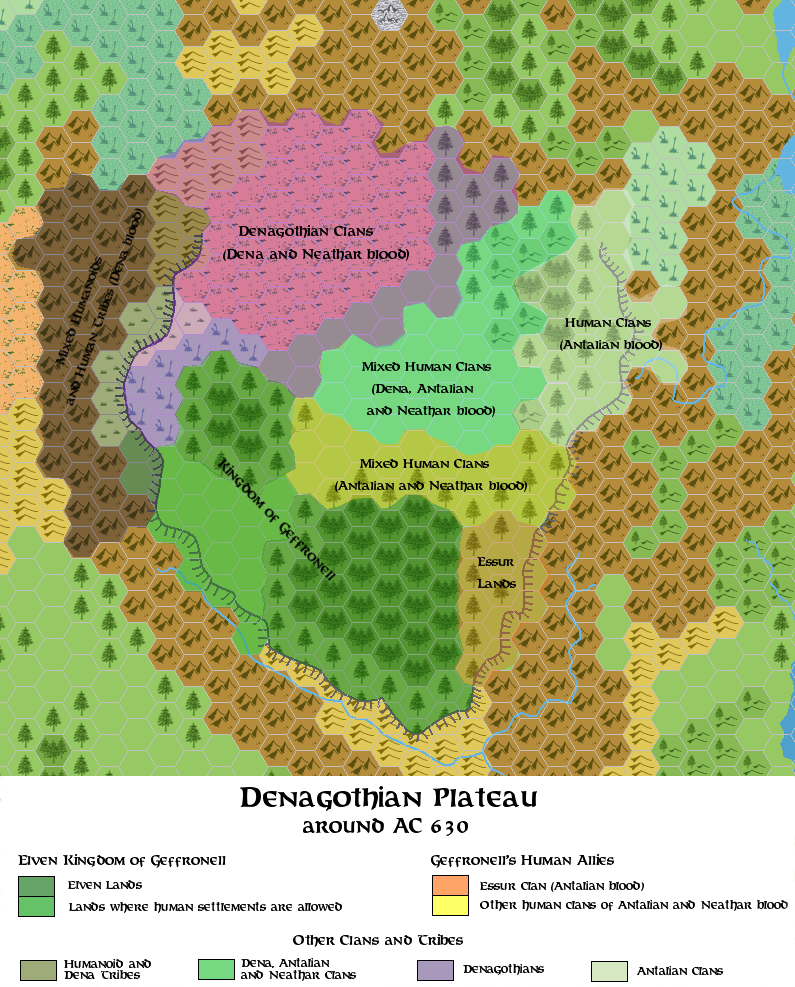
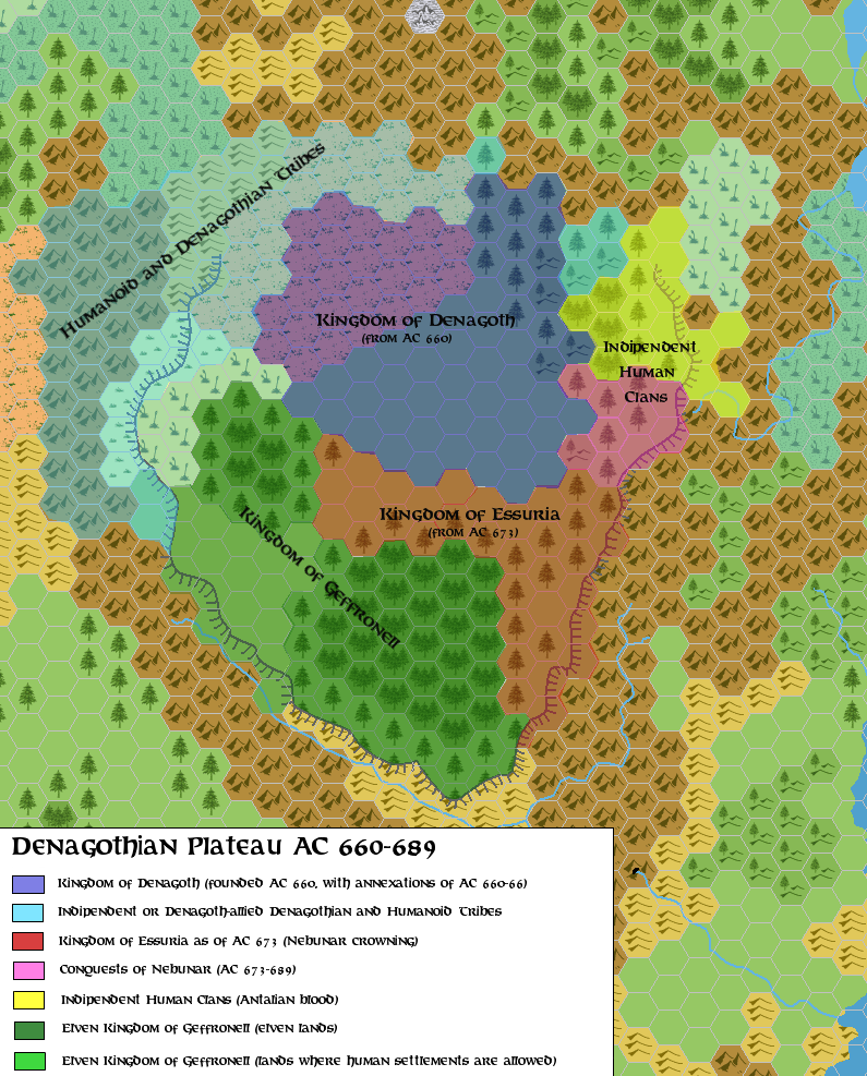
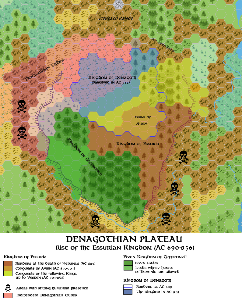
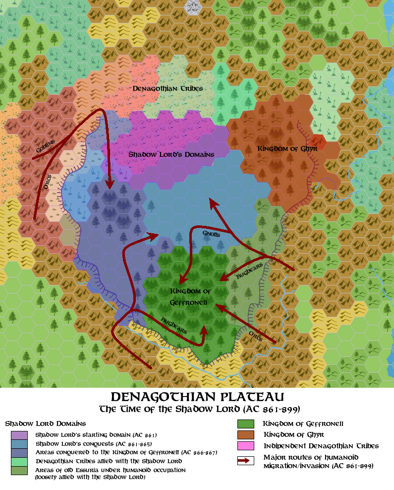
Denagoth historical maps
by Simone NeriI've made some historical maps featuring the Denagothian Plateau in five moments of its troubled history. They're consistent (I hope) with DM's new Wendar-Denagoth-Northern Wildlands timeline but show only what happened on the plateau (so, you'll see no Genalleth or Nimbeth maps, sorry).
Even if the maps are closely tied to DM's timeline, I'll post the maps here because they're all about Denagothian Plateau.
(P.S.: I've borrowed Thorf's map symbols from his "Legend" file to draw the map. The solution adopted for the Norwold-Denagoth-Northern Wildlands-Heldannic Territories maps follows the one showed in the map posted by LoZompatore in the "Kingdom of Ghyr Project" thread - I'll post a larger version of it, which includes northern Norwold, if someone is interested. All the data of the map are closely canon-based).