
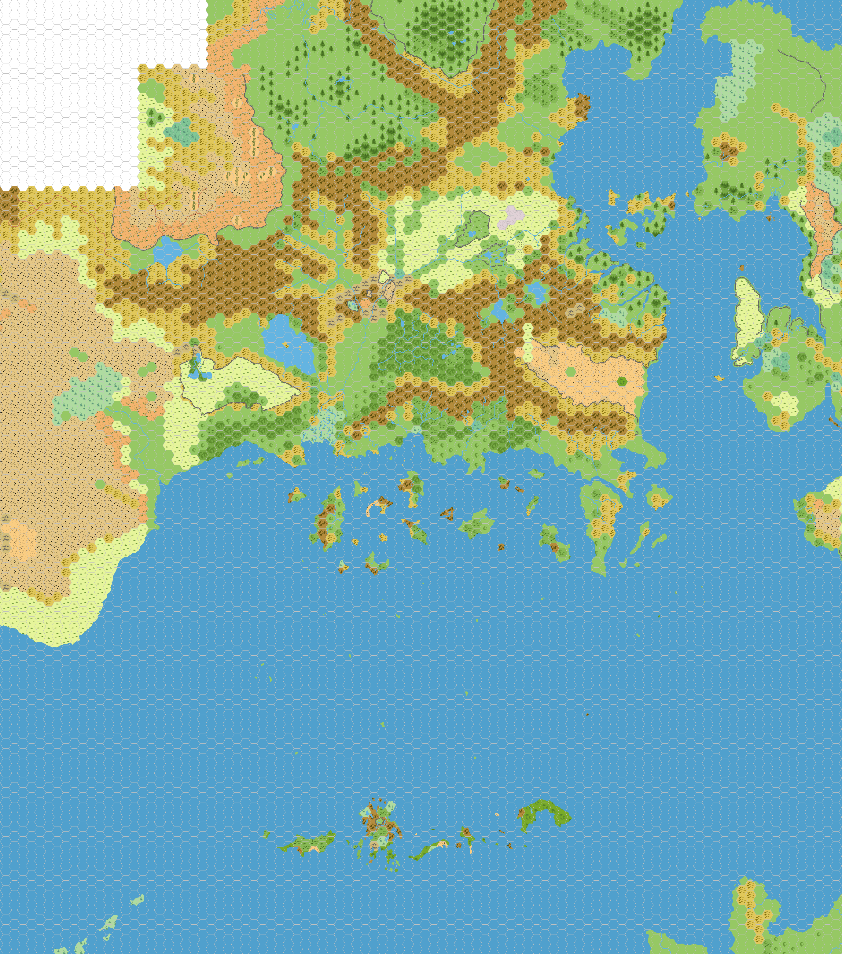
Updated 24 mile hex map of the Known World
by Simone NeriHere's another 24-miles map of the Known World I've made for our Mystaran Demography project at the Italian MMB. I post it here also because perhaps some of you can be interested in it.
The map is updated, i.e. the 24-miles hex terrain types, borders, etc. have been positioned using a 24-miles grid overlay over the 8-miles GAZ maps. This was done because canon KW 24-miles maps were largely inaccurate and inconsistent with maps from the GAZs. So do not be surprised if you find some difference between known KW 24-miles maps and this one.
Here's the blank version of the map:
Some explanations:
Atruaghin: The reference here was Thorf's updated map, since GAZ14's one is known to be wrong.
Heldann/Norwold Border: The solution adopted here follows the one used in my Norwold 24-miles map, in the topic Norwold from the Italian MMB.
Isle of Dawn: Exact position of the IoD has been determined accordingly to TM2 map.
Karameikos: Reference here is again Thorf's map of the Grand Duchy, in particular the version with forested hills (which is more consistent with GAZ1's description of the area).
Northern Wildlands: Rivers featured in the map are borrowed from OldDawg's Northern Wildlands GAZ, even if I've kept canon terrain types.
Sind/Glantri Border: Here the CoM's map has been followed.
Thanegioth Archipelago: I've added some minor island, following Mark Howard's 8-miles map of the area, at the Vaults.
Wendar: I made some minor changes to Thorf's map to keep canon 8-mile map pieces of Wendar (mostly from GAZ3).
Last but not least, you'll find a small island some hexes south of Trader's Island. This is the isle featured in the AC10 adventure "Isle of the Storm Giant" - this is an addition to canon maps.
Another mountainous island many hexes south of Hattias - not featured in canon KW 24-miles map - is the Burning Mountain, an island featured in XS1 "Lathan's Gold".