
Darokin and surrounds
by Mike PhillipsTwo historical maps (BC 300 migrated from the Malpheggi Swamp thread), which I think help a little with discussion:
BC 300:


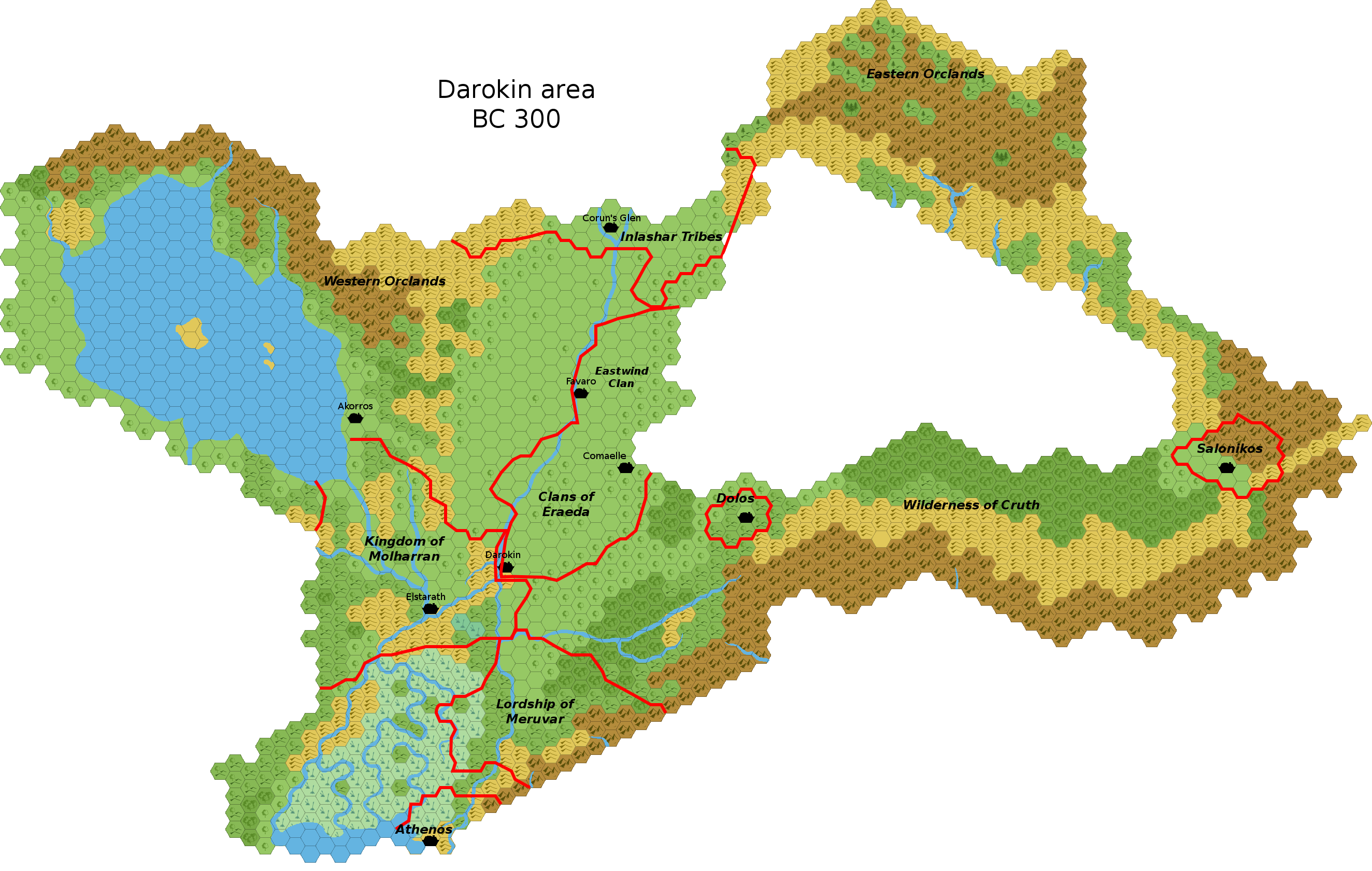
I pulled in Elstrich (as Elstarath, it's BC 300), Salonikos, Athenos, and Dolos (all as towns). I was going to ask what else would have been around, but that list is a good start. (I have since added Favaro, Akorros, and Corunglain (as Corun's Glen).)
I did a straight copy of the geography from modern Darokin, so that will eventually need to be adjusted, and at some point some of the surrounding land should be pulled in (some of the borders stop abruptly due to the map)
...and the gimp file in case anyone wants to play around with it in hexgimp. (It has layers for the current cities, ancient cities, etc. I've been using layers to overlay era-specific changes, so I would expect to add layers like "Forests (BC 300)" to handle redrawing the forested areas, for instance. This way, also, the BC 300 and AC 700 maps can be in the same file.)
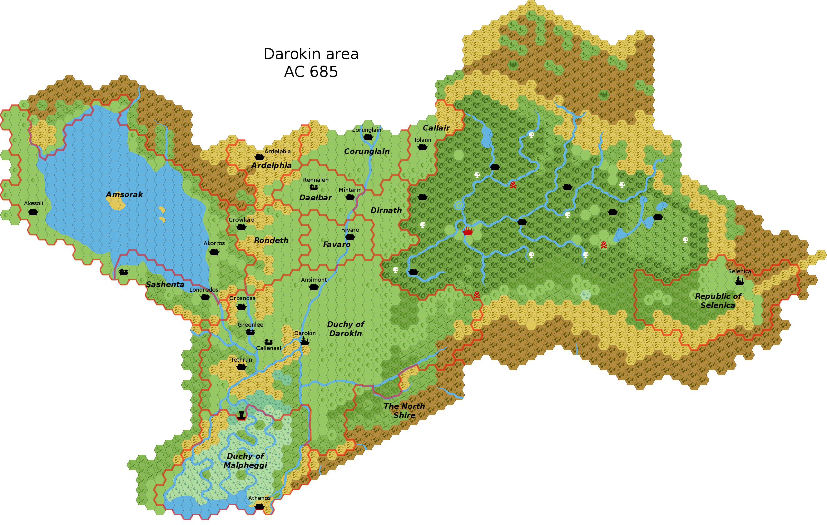
AC 685:
AC 700:

I arbitrarily placed towns/villages (e.g. Londredos) which didn't have a suggested placement (e.g. Rennalen) or a placement derived from the swamp effort (e.g. Tethrun, Callenaal). I also tweaked the terrain slightly from AC1000, shrinking the swamp south and sprinkling forests in a few spots near other forests. (I would expect that Akorros, for instance, does enough shipbuilding to strip the forests around it, so I put some back to indicate it was an earlier time.) I also put keeps in place of a couple forts, where it looked like borders went around them (specifically, Selenica), and threw a village in west Sashenta where it seemed something was needed to stake Sashenta's claim out.
Town/village distinction is pretty much arbitrary, but I assumed capitals would be towns, and only Darokin might actually be large enough at this point to be a city (and I'm not even sure about that). I would imagine that once the wars are over and things settle, there will be a population explosion over the next few generations (there's plenty of food and work to be had), but until that point there is enough war and death to keep settlements smaller.
In working on this, it occurred to me that one major thing missing from the canon Darokin map is a settlement at the mouth of the river out of the lake (which Geoff and I named Sashenta elsewhere). You'd think it would be a natural waystation, which is why I put Londredos there.
From an adventuring point of view, the placement of Tolann is suggestive, if one runs anything set around Fort Nell.
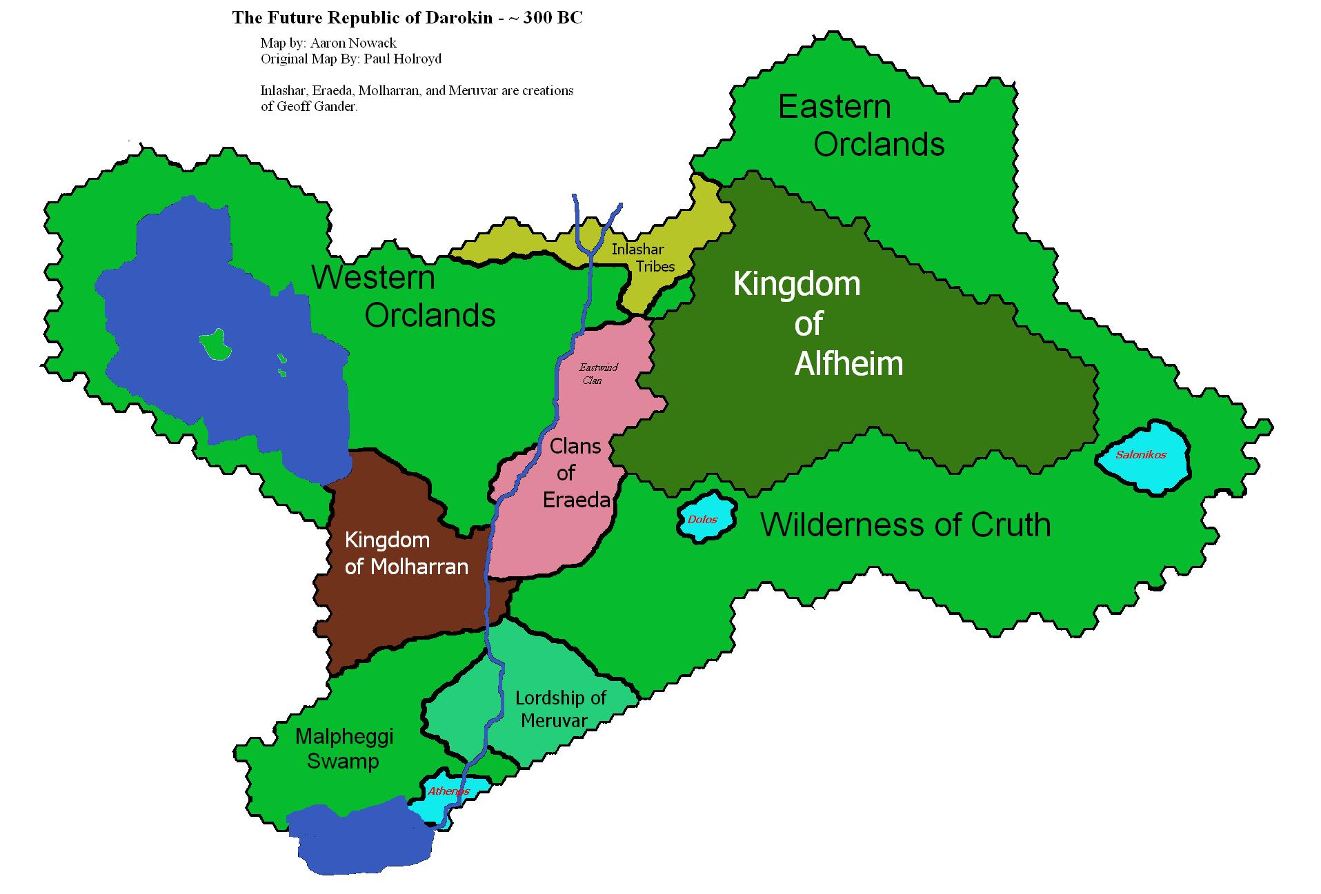
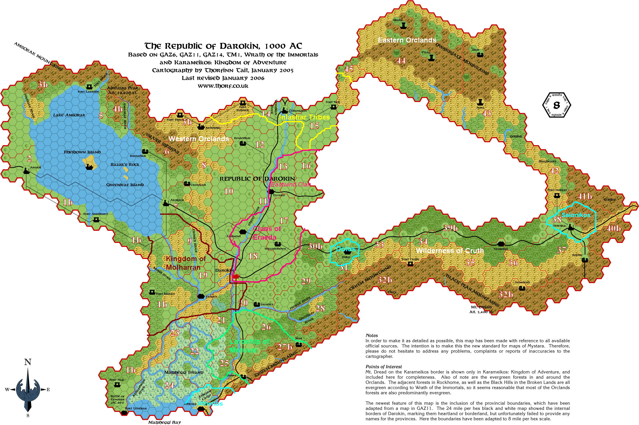
Edit: Credit obviously goes to the previously developed maps: