
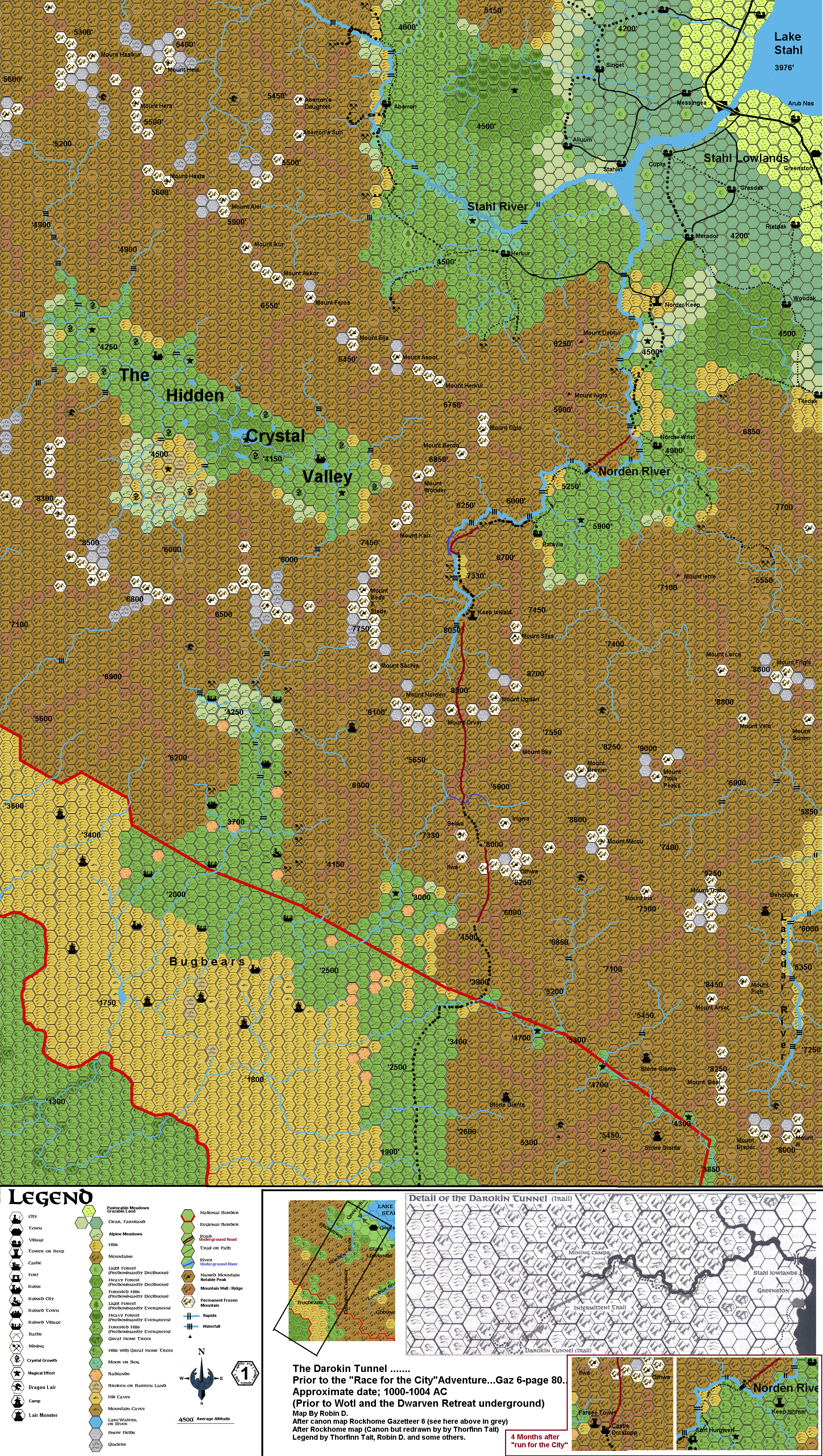
Darokin Tunnel Map in 1 Mile Hexes
by RobinThis is a remade old map of mine.
In Gazetteer 6 (Rockhome) the Darokin Tunnel is mentioned in a nice adventure "Run for the City".
But the map provided there was lacking color, and more detail.
So...I added creeks, currents, waterfalls, mines, caves, lairs, Mountain names,
ruins (of a bygone experiment of the Dwarves..but abandoned after a great fight...hence the ruined villages/and even a city and town...they are all empty now, except the local bugbears who live nearby),
and the Hidden Crystal Valley (a location only flying creatures can reach, there are no tunnels or passes into the area, and prolonged exposure to the crystals will affect you...the few who did manage, eventually perished...but that is up to your DM...)
The Map is made by the Hex Icons of Thorfinn Tait, and I added some of my own and others for more detail.
I did this in paint by cutting and pasting...I don't have special programs to do this (like Thorfinn), so there will be minor mistakes, glitches, shifted hexes, and such. Please ignore these...the map on itself is good enough to enable you to work while ignoring these...I hope...;S
The legend will explain most.
The Greymap (large Hexscale 8 mile, small Hexscale 4 mile), and the small area map (Hexscale 8 miles) are for reference where this area is.
The two small maps in the lower right corner (dark red bordered) are a minute change to the area after the adventure "Run for the City"...where the dwarves will have erected more powerful and functional barriers. A small garrison of 100 armed dwarves will reside in the Castle and the same in the Fortress. The Keep holds 40 Dwarves and 5 befriended human mages. These numbers can rapidly be increased when the Farsee Tower discovers approaching enemies (vision 24 miles even in fog due magic monocular), and signals the Castle, and they the Fortress.