
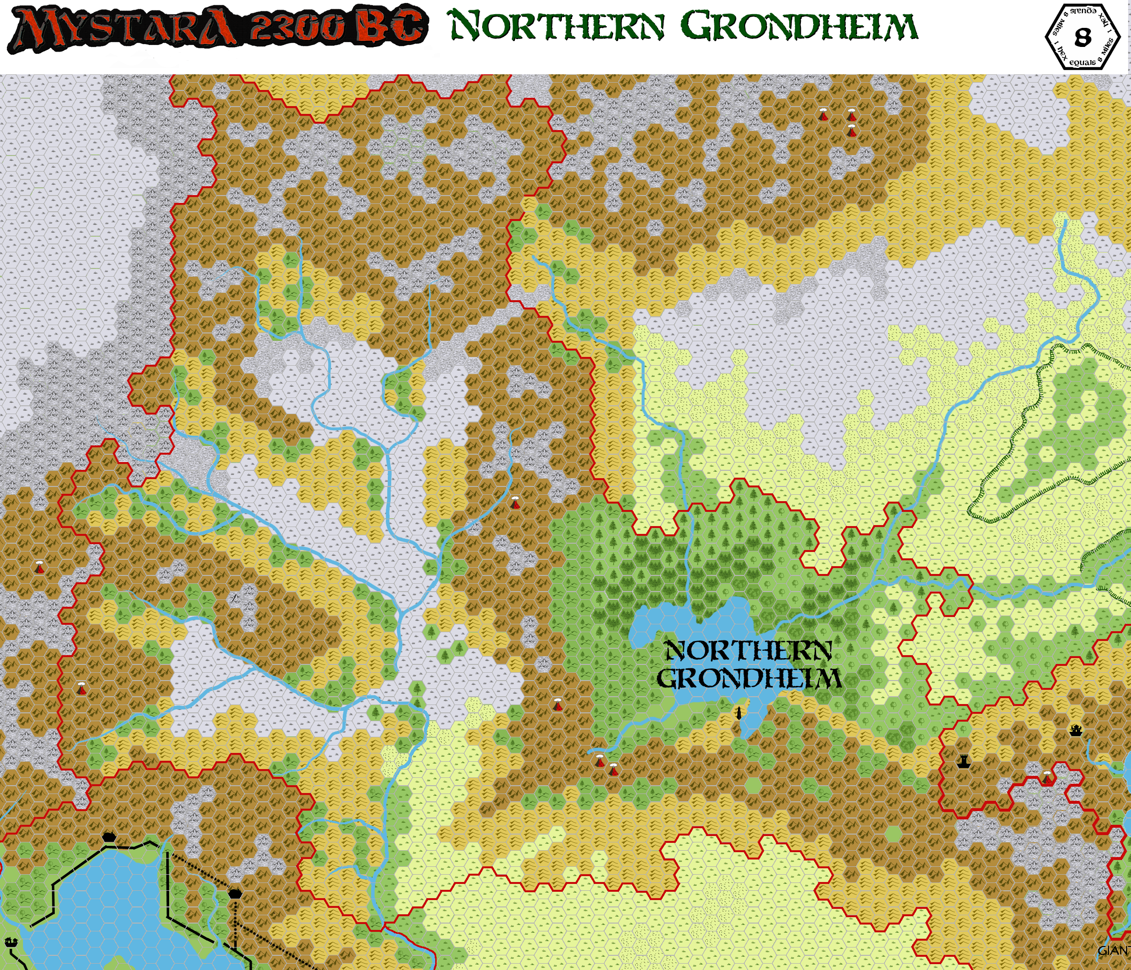
Grondheim 2300 BC, 8 miles per hex
by John CalvinMaps
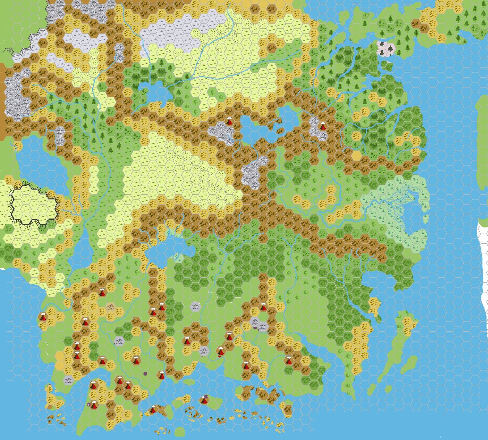
Map of Northern Grondheim, 8 miles per hex by John Calvin, July 2012 (Work In Progress)
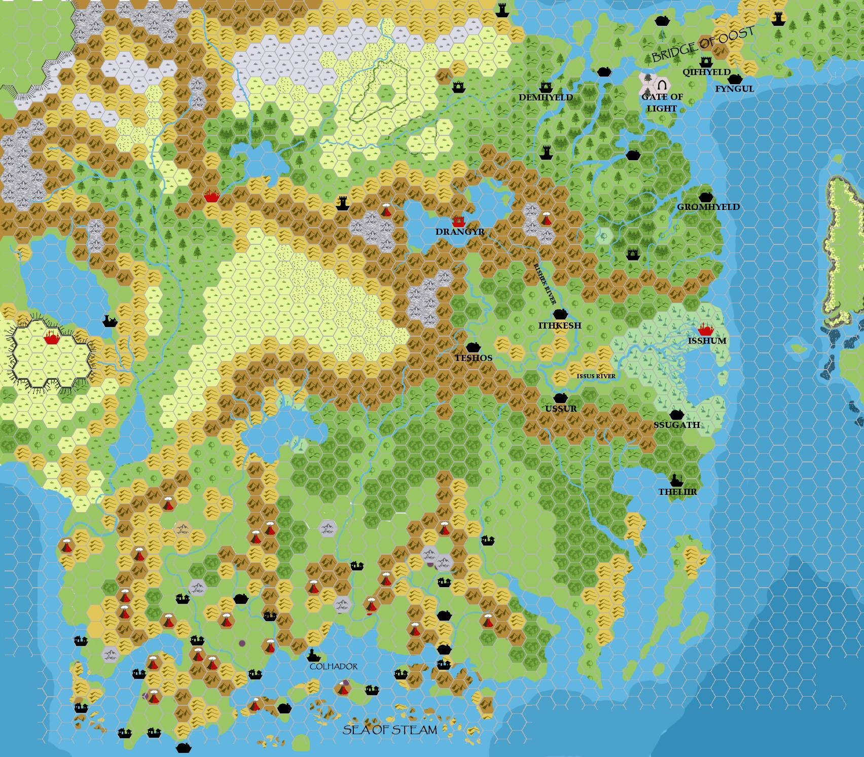
Map of Southern Grondheim, 8 miles per hex by John Calvin, July 2012 (Work In Progress)

Comments
These maps of Grondheim in 2300 BC cover portions of current day (1000 AC) Karameikos, Alfheim, the Broken Lands, and Glantri.
The features are currently incomplete, however I'd like to get input from the group in filling out the rest of the areas.
Sources:
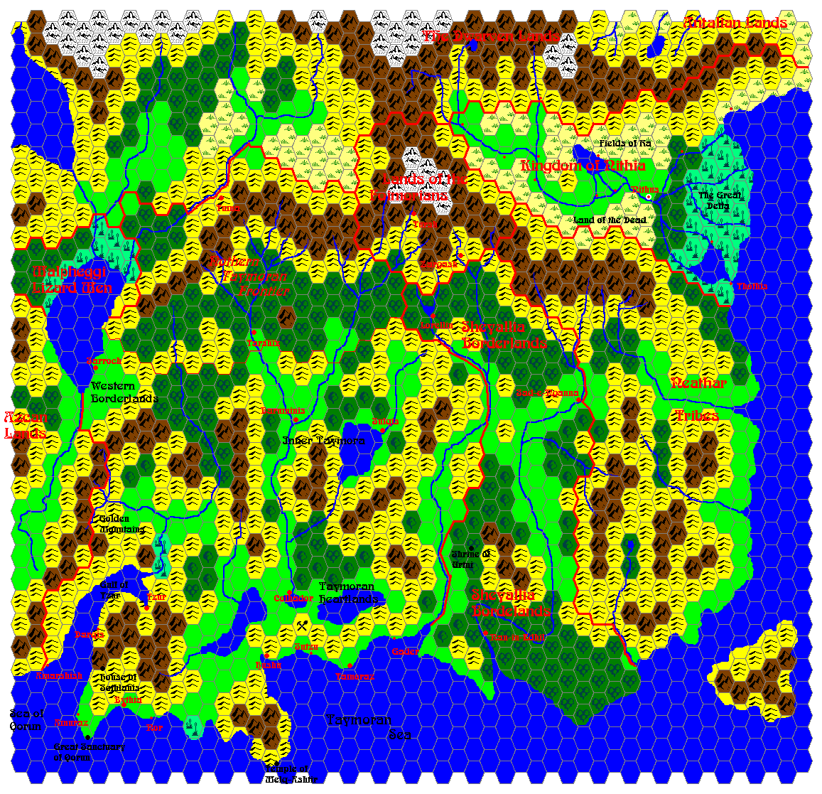
Unofficial Maps: Taymora BC 2300 by John Calvin, Taymora BC 2300 with cities by John Calvin, Geopolitical map of Taymora (2004) by Giampaolo Agosta.
Notes on XXX
- I've added 2 locations from GP's Cruth Lowlands work - The Mound, and The Turnwood.
To Do List
- Continue to name all major geographical features.
References
- Outer World: Taymora 2300 BC, 24 miles per hex
- Historical Mapping in the KW and Sea of Dread
- Lords of the Cruth Lowlands
- Karameikos developing thread
Thanks to: Thorfinn Tait, for providing some wonderful graphics to use in all of our mapping projects. Thanks also to agathokles, RobJN, and Sturm for contributing to discussions that have helped to flesh this map out.