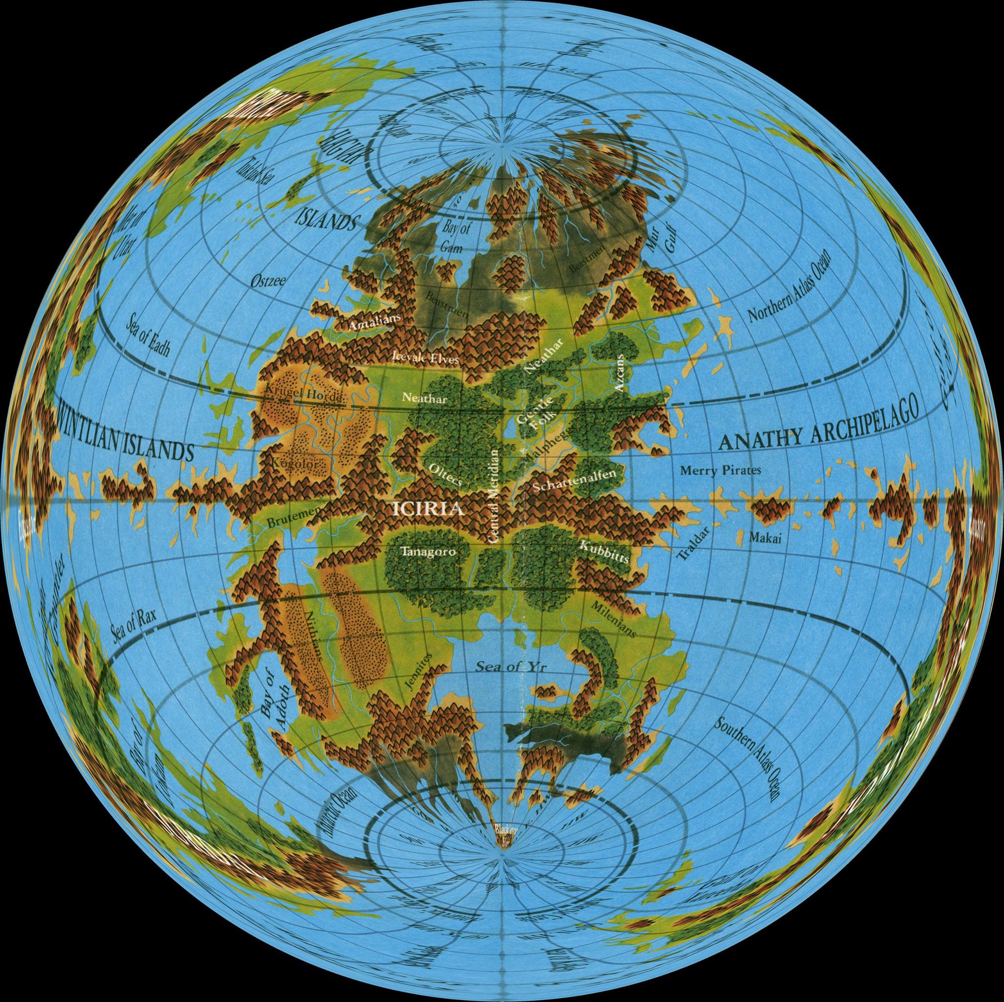
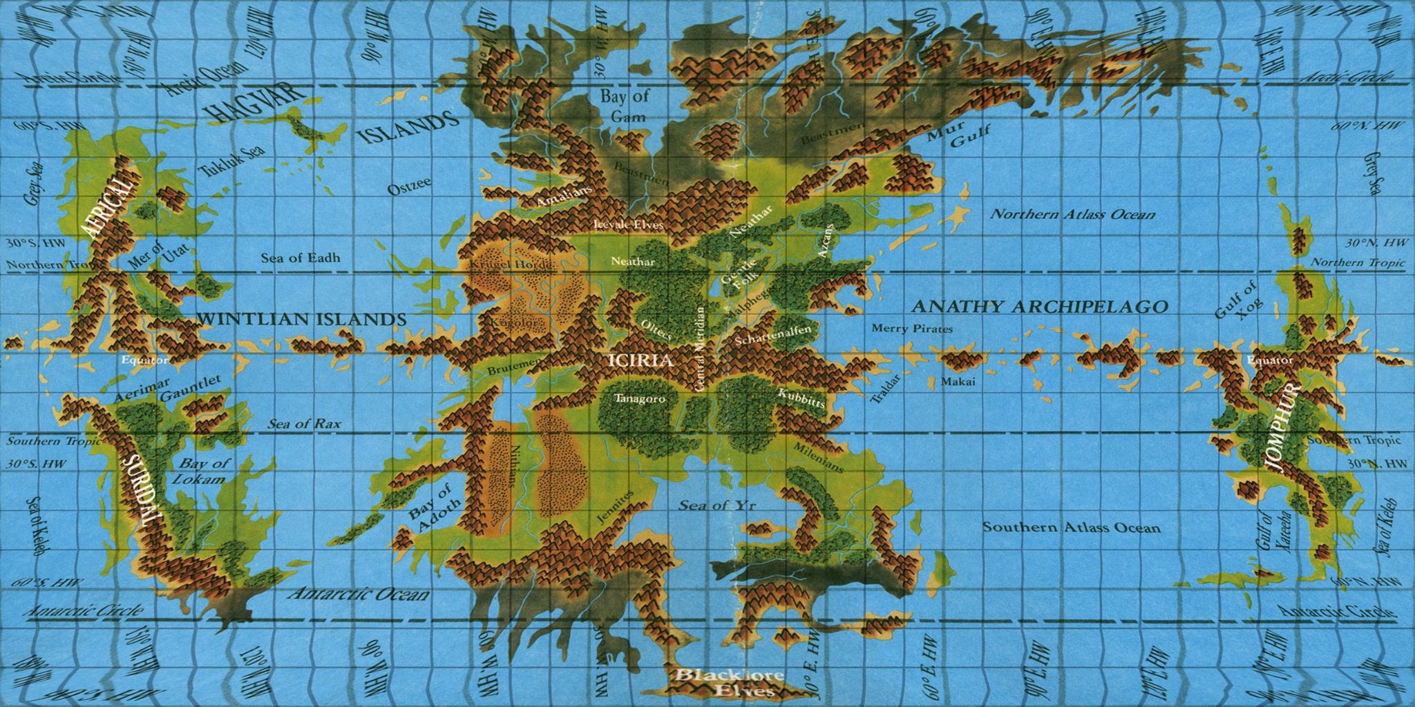
Reprojected maps of the Hollow World
by Thorfinn TaitHere is my reprojected version of the Hollow World overview poster map. I added the extra graticule grid lines, then geotagged each vertex. That then allowed me to warp the map, mapping it to a known projection (Plate Carrée, aka Equirectangular).
There are a few possible issues with this approach. Most notably, I ignored the lack of a polar opening, assuming that the upper and lower latitudes folding into the polar lip are roughly equivalent to what would be there if the world was just a normal ellipsoid. In other words, I just did it as a sphere.
I think this actually works out okay, especially given that Blacklore in the extreme south is supposed to be inside the polar opening anyway. Moreover, the Iciria hex map implies agreement too, as it lines up nicely with this map — albeit in its poster map format. (What this means is that north is not always up on that map, as illustrated in the Iciria hex map with added graticule that I posted recently.)
Having the whole world georegistered means being able to change the projection, which enables us to produce cool things like this map. This is my favourite projection for showing the Hollow World, because the perspective really gives the feeling of looking inside the world.