
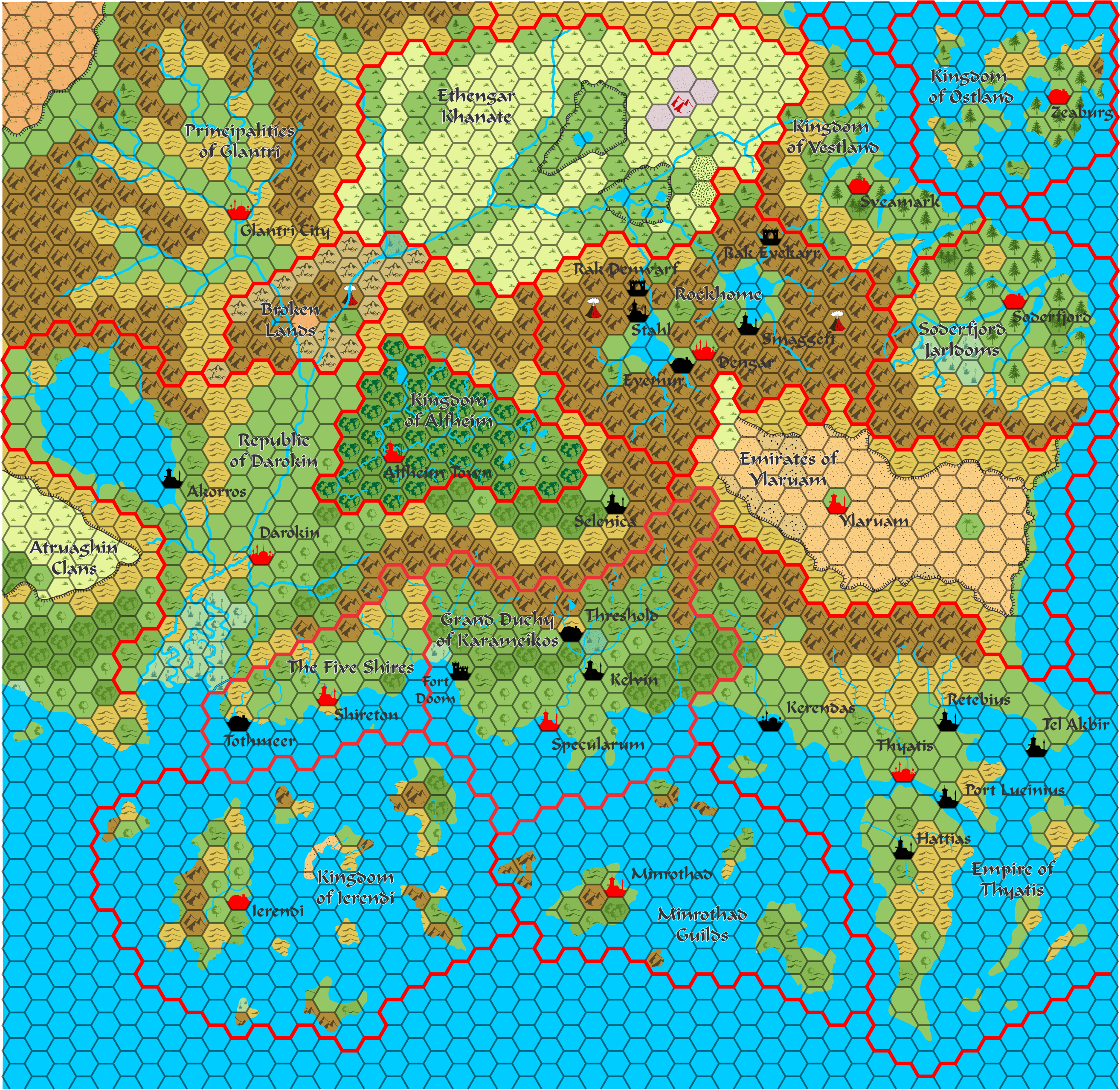
Known World, 24 miles per hex
by RindisI started this ages ago, did a bunch more work at the start of this year, and finally finished it off.
It's what we've all seen before, a re-do of the upper half of the X1 map. I kind of felt I wasn't mapping Mystara if I didn't have that in my library.
What's different? Lots of little things. My initial impetus was Thorfinn's 8-mile map of Karameikos, where he switches a lot of terrain to wooded hills, as GAZ1 describes it that way, but didn't have that terrain type yet. I noticed no one had really gone back and re-done the 24-mile maps with that either. As I went, I ended up scaling up Thorfinn's 8-mile map of the Known World to the original scale, adding in features the Gazeteers had added.
So, it's a much more nuanced version of the old familiar, and as far as I know, no one's gone back to this as a systematic thing before.
All done in CorelDraw using Thorfinn's reference symbol set.