
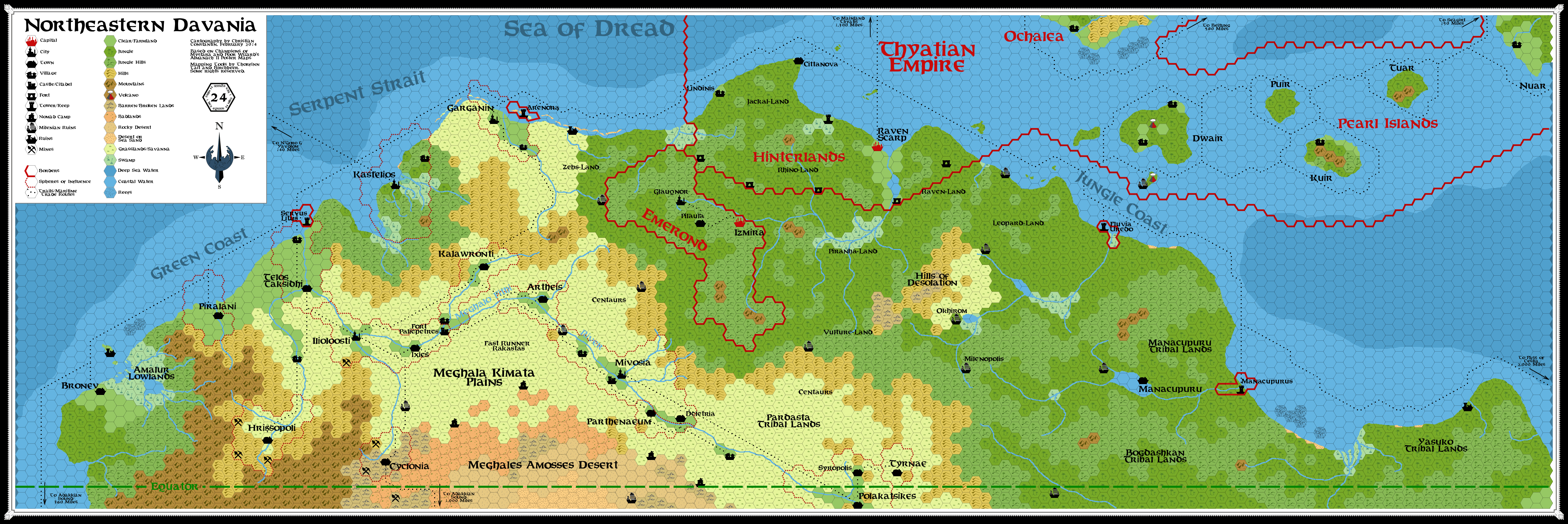
Northeast Davania Map, 24 mph
by Christian ConstantinAs part of a discussion about Thyatian and Hulean colonies on Davania, I have created a 24 mph map of the regions of Davania covered in the PWA II 72 mph map. This map is meant as a discussion tool (Edit: this link now points to the second version of the map.
This is my first attempt at messing around with both Gimp and Davania. That's a 24 mph map of Northeastern Davania. I have tried to integrate as much fanon as possible while being respectful of canon. This has meant some tradeoffs and modifications on earlier works. In no way is this meant to be authoritative, I just hope to provide some support to this thread and, eventually, to include a version of this map in a future issue of Threshold. Basic hex layout is based on the 72 mph PWA II map of the Sea of Dread Region.
Here are a few modifications/elements/issues worth noticing:
1- I have re-worked the Hinterlands area. This region had been previously mapped at the 24 mph scale, but in light of some distance issues raised in the colonies thread mentioned above, I have taken the liberty to modify it. I have tried to keep the spirit/general layout of the previous map intact, but there were important changes.
2- I have also used the MA 1019 8mph map of the eastern Meghala Kimata plains as a source of inspiration for this map. However, some abovementioned mapping problems had also been replicated in this map, so I had to modify it as well.
3- Despite some discrepancies between the PWAII 72 mph map and the CoM 24 mph map section of Garganin/Kastelios, I have tried to stick with the latter for this area of my map. The area around Kastelios has also been updated to depict some details provided by Bruce Heard's map of the City-State (based on Geoff's map IIRC).
4- The Pearl Islands and the southern tip of Ochalea were slightly modified from the PWAII map to better fit the more detailed DotE Map (p. 78).
5- Some smaller rivers were added or extended to reflect larger-scale mapping. The main east-west Hinterlands river (anyone knows its name?) has been brought further south (if compared to the abovementioned Hinterlands map) to be closer to its PWAII course.
6- Milenian ruins dot the land. In choosing their locations, I have basically followed Havard's map of the Outer World Milenian Empire. Of course, some of these ruins might be little more than piles of rubble, pillaged long ago of any riches, while others might have been left in more pristine conditions. I hope to give some details in the upcoming article.
7- Borders: I personally would have prefered to have a border-less plain dotted with City States. Their borders would have been in a near constant flux. However, Bruce Heard's map of Kastelios and the MA 1019 map gave borders to the City States' dominions. I have followed, with the exception of Garganin.
8- In line with Havard's suggestions in another thread/map, I have located the cities of Sasserine and Cauldron (re-christened Calderan) southeast of Garganin. I am not, however, very knowlegeable about that line of campaign. So perhaps placing these cities where I did was a mistake.
9- Time. I usually base my map in the Gazetteer era (1000AC). However, for this map I had to contend with maps of different (future) eras. I know of at least one anachronism: the city of Vanyapolis should not exist before 1019 (and will likely be replaced by a village in the next version). I haven't removed it yet because I was unsure if I should also modify the borders of an earlier Polakatsikes/Eastern plains area.
10- New features. I've added new cities in the western area of the Meghalo Fithi valley (Milenopolis, Artheis) to balance the MA 1019 depiction of the Eastern Valley. Bronev, near the Amalur Lowlands, was taken from A. Mishler's work. Piralani is meant to be a second Hulean colonization failure. In the words of one Minrothad merchant prince to his son: "You will never find a more wretched hive of scum and villainy. We must be cautious"...
11-Coastal towers and ruins. Towers are meant to be active slaver camps. Ruins could either be former camps or failed colonies.
12- I might be tempted to add a 2-3 more Hinterlands clan names south and west of Thyatian lands.
13- I started mapping one hex west of what I had calculated when creating the grid, that's why I stopped short of mapping the continent all the way to the eastern edge depicted in the PWA map. Is there any way to expand a map once the grid is established?
Many of these issues go well beyond my Hulean/Thyatian colonies project and my knowledge of Davania. In fact, I believe many questions raised above would deserve a full discussion either here or in the Davania Issue of Threshold. My two cents on some of these issues:
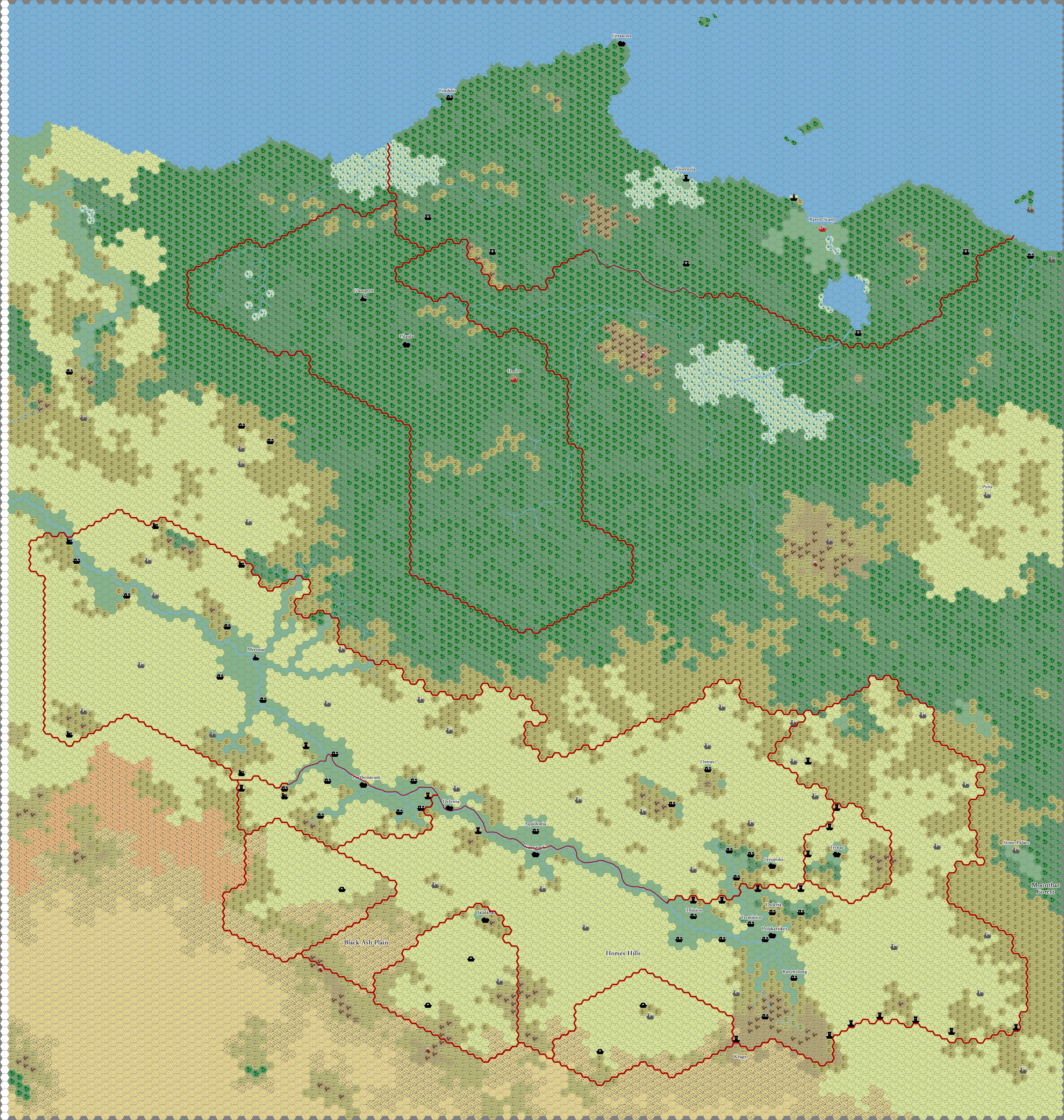
The Map
Regarding the map, I think I will keep it as it is for the most part so it can be used for others' projects. I will be happy to amend city names to reflect further development of the area and better understanding of its history. I will probably remove the name tags on Cathos/Vacros since there are diverging views on the subject, but leave the islands/features there as they are supported by older canon and fit with the description of the Pearl Islands. I'm likely to mess around a little with the Jungle Coast to better reflect the PWA description by adding more swamps/sand beaches. I might add some labels for Pardastas and Centaurs in the plain.
Thratians
Concerning Thratians, I thought their pedigree was more or less straightforward in canon: Antalians by way of Nithian deportation/slavery.
After immersing myself in the fascinating fan-documents about M-ethnographic history I see that fan work supports in part this point of view, with two differences: (1) a minor one, the Antalian and proto-Thyatian/Kerendan groups had split before the deportation, and (2) a more important divergence, the existence of a Neathar Thratian culture before Nithian presence in the area.
Though canon is silent on the matter, I had also always assumed a Hinterlanders/Dawn Islanders kinship due to cultural similarities. My point of view was that both groups had common roots and perhaps even a shared history of Nithian deportation: Antalian slaves being brought to the southern Isle of Dawn (Caerdwicca). Others might have migrated naturally to the northern Isle of Dawn (Dunadale). Contributors to the Ethnography projects have taken a different perspective on this point. As mentioned above the connection between the Hinterlanders and Dawn Islanders would predate and not be related to Nithian actions.
Of course, the problem with the canon story is that Thyatians, Kerendans and (to a lesser degree) Hattians do not share much culturally with modern-day Hinterlanders (M-Picts/pre-Christianity Irish). Intermingling with Milenians helps explain the differences to a certain extent (see THANTALIANS). Now, my problem with a pre-existing culture in the Hinterlands is that Nithia probably wouldn't have needed to bring slaves there. It could have simply enslaved the locals given its vast magic-technological superiority. Then again, this seems to be established fanon and it's rather remote from my usual Mystaran ballpark.
Nevertheless, as far as modern Davania is concerned, both approaches ( (a) Thratians of Antalian slave-descent or (b) Thratians as a mix of (a) with pre-existing Neathars) would yield a host of Celtic-style barbarian tribes in the jungles and perhaps some culturally celtic (British Islands-style) settlements at the edge of the eastern and northern sections of the plains.
Yasuko-Ochalea
My view on this point is a reflection of my take on M-Orient as it is displayed in canon: I hate it and don't use it in my campaigns (as a student of Chinese/Asian politics and history I've always been shocked by the lackadaisical treatment of Asian cultures on Mystara: want a M-Orient setting? Let's plant an Alphatian offshoot on Ochalea and make it M-China...). I've never ended up developing my views on Skothar, but my idea was of having Tanagoro-descent Middle Kingdom in Skothar. From this perspective the Yasuko people would be of Tanagoro descent (I believe I also read something along this line somewhere), perhaps akin to black M-Ainu.
M-Saharan Cultures
I'd say Oltec-Neathar mix, perhaps with some Tanagoro. They could be found in the foothills of the Adakkian Range (along springs and oases) and in Upper Arypt.
Bogdashkan Orcs
If the name of the orcs is indeed related to the Chinese Bogda Mountains (Shan just means mountains), then the root is Altaic/Turkic not Chinese. Bogda either comes from Uyghur or Mongol, not Chinese (Chinese pinyin transliteration = Bogeda Shan). Perhaps lost colonists from Hule?