
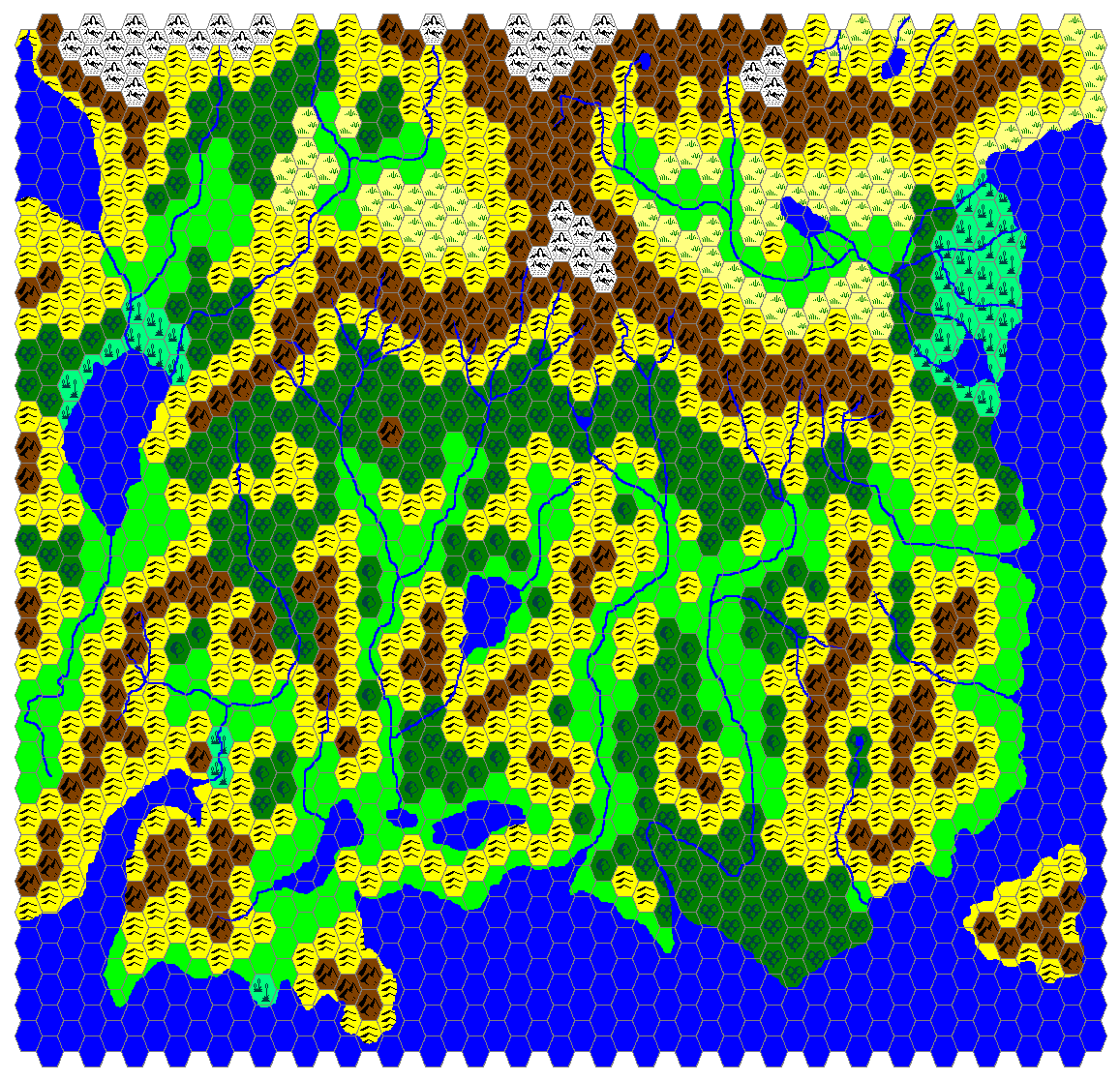
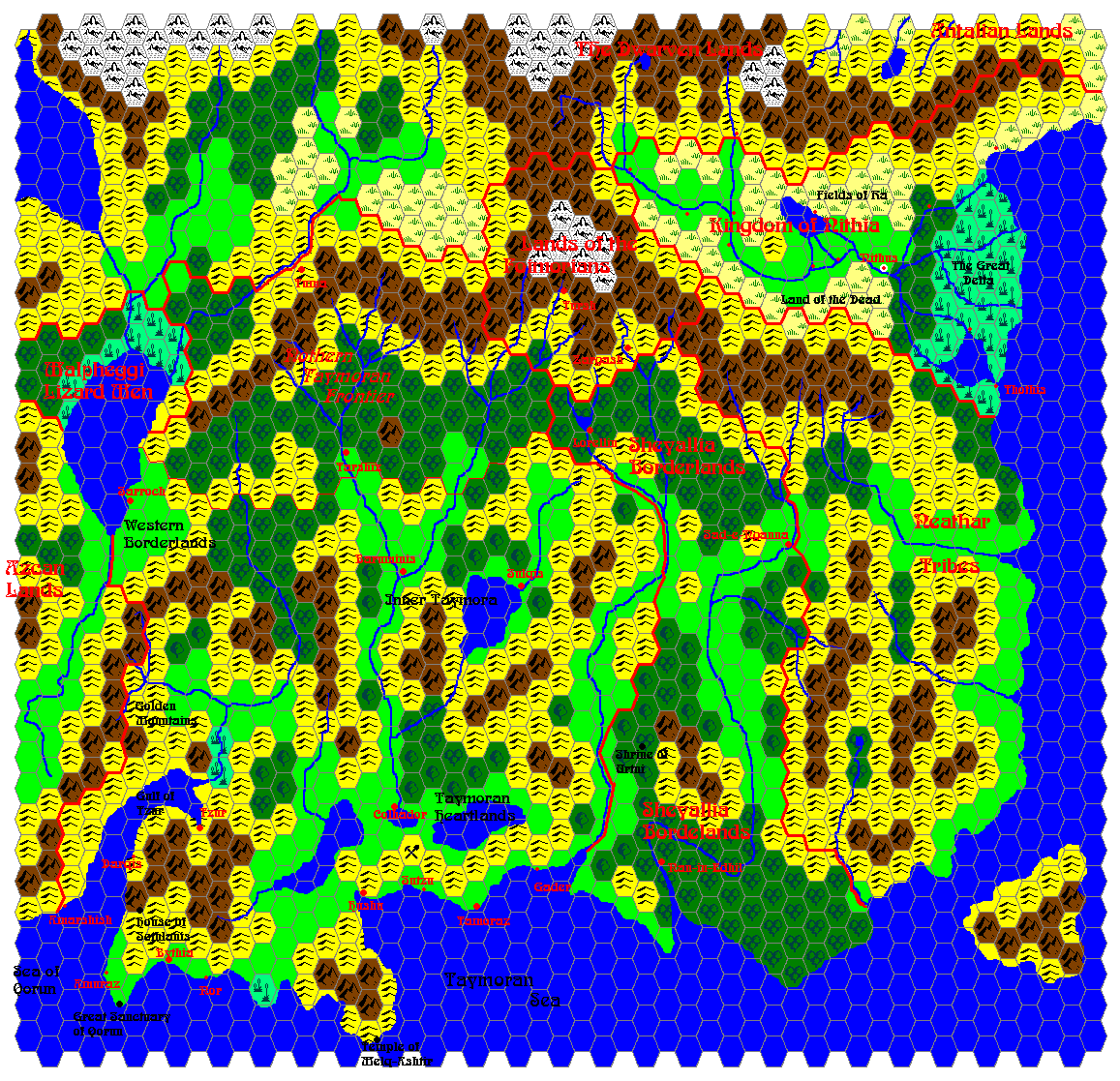
Shimmering Lands 2300 BC, 8 miles per hex
by John CalvinMaps
Map of the Shimmering Lands, 8 miles per hex by John Calvin, March 2009 (Work In Progress)
![]()
Comments
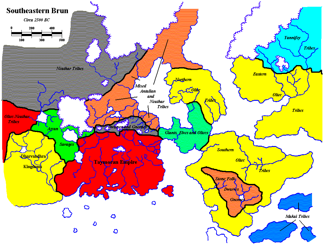
This map of the Shimmering Lands in 2300 BC covers areas of current day (1000 AC) Ethengar, Rockhome, Northern Reaches, Darokin, and Ylaruam, as well as lands that sunk beneath the sea in 1700 BC.
Sources: GAZ6 The Dwarves of Rockhome (1988), GAZ7 The Northern Reaches (1988), GAZ12 The Golden Khan of Ethengar (1989), TM2 The Eastern Countries (1989)
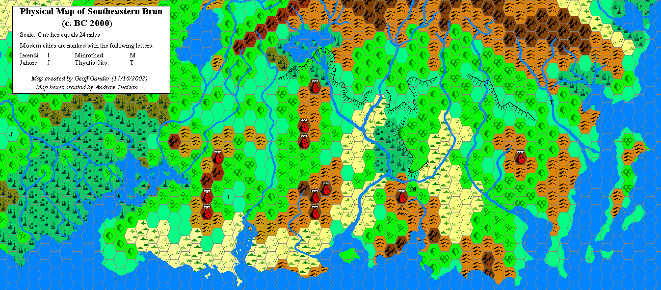
Unofficial Maps: Taymor at the Vaults of Pandius, Physical Map of Southeastern Brun (c. BC 2000) (2002) by Geoff Gander, Map of Taymora (2003) by James Mishler, Map of Southeastern Brun: 2500 BC (2003) by James Mishler, Geopolitical map of Taymora (2004) by Giampaolo Agosta, Taymora BC 2300 by John Calvin, Taymora BC 2300 with cities by John Calvin.
Notes on Shimmering Lands
- I have placed the land bridge from Brun to the Island of Dawn going through (and incorporating) Ostland. Other maps have placed this land bridge in different locations, but after studying the terrain extensively, this is the location that makes the most sense to me.
To Do List
Add Kogolor settlements to the map (most likely in the Rockhome region) once their history is integrated with the Shimmering Lands timeline.- Continue to name all major geographical features.
References
Thanks to: Thorfinn Tait, for providing some wonderful graphics to use in all of our mapping projects, Geoff Gander, Havard, RobJN, yellowdingo, Hervé Musseau, Giulio Caroletti (all for providing insight and support on this project).