
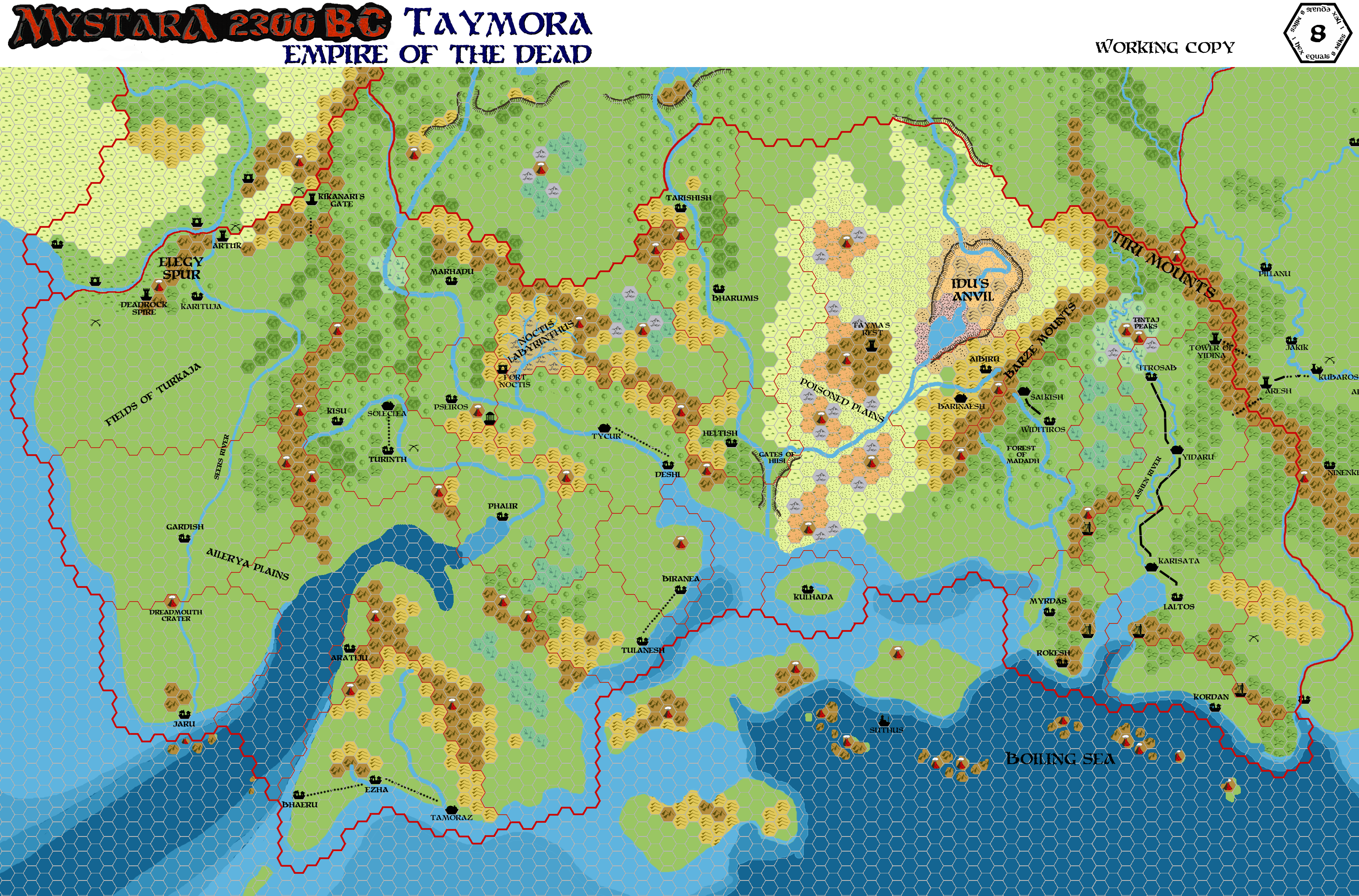
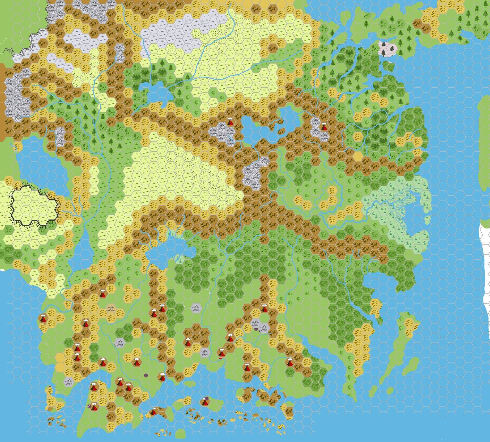
Map of Taymora, 8 miles per hex
by John CalvinMaps
Map of Taymora, 8 miles per hex by John Calvin, September 2009 (Work In Progress)


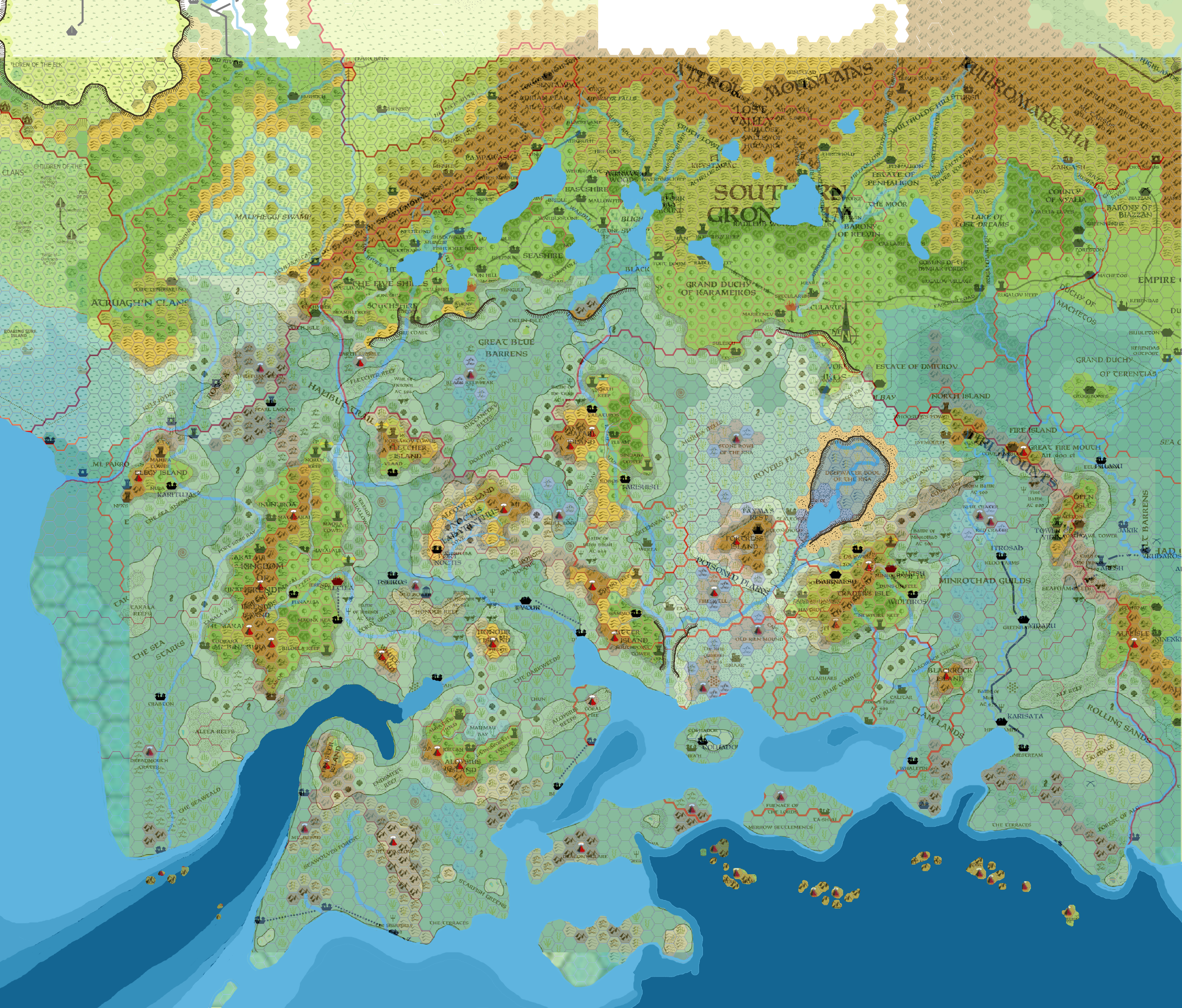
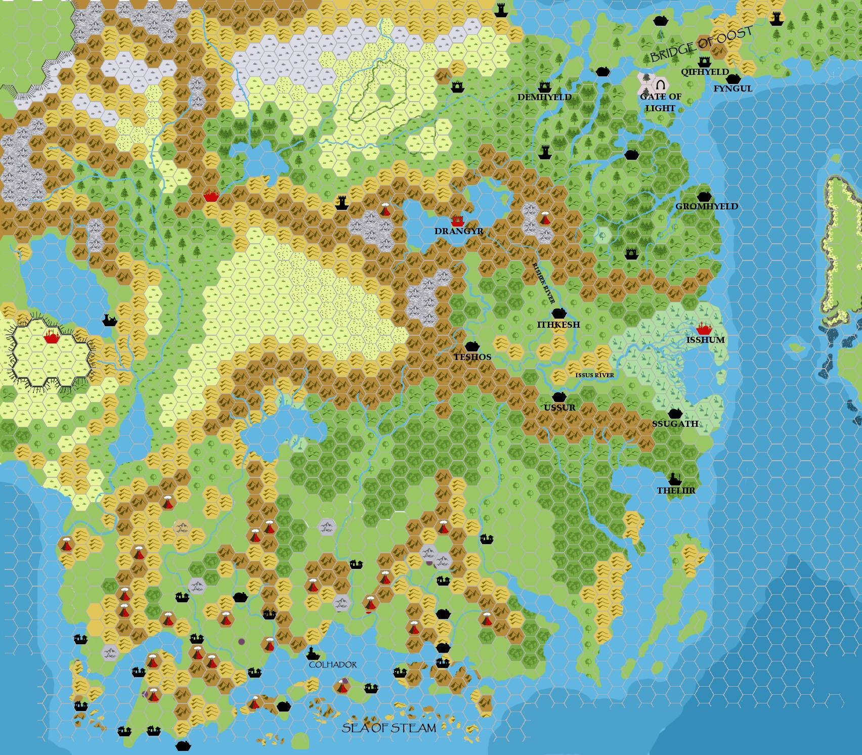
Overlay of Taymora and Known World, 8 miles per hex by John Calvin, August 2013
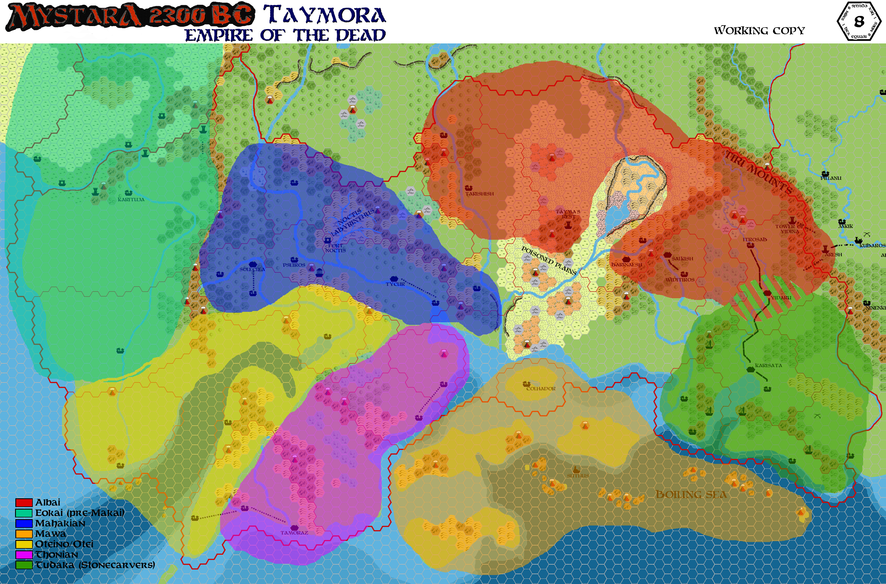
Taymoran Cultural Demographics, 8 miles per hex by John Calvin, August 2013
Comments
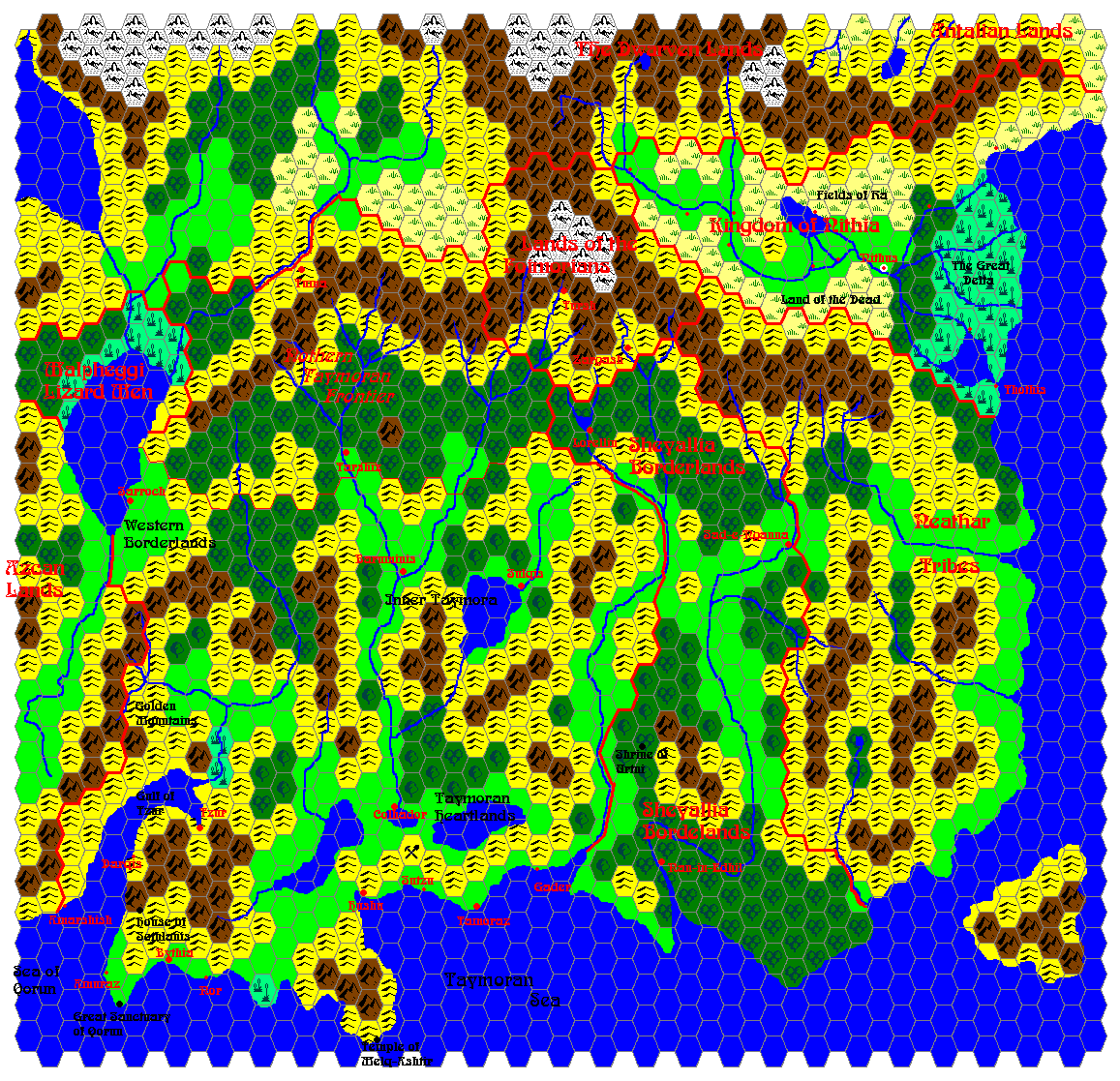
This map of Taymora in 2300 BC covers portions of current day (1000 AC) Thyatis, Karameikos, The Five Shires, Darokin, Atruaghin, and the Sea of Dread, as well as lands that sunk beneath the sea in 1700 BC.
At the moment the only features seen on the map are features that could be pulled directly from the corresponding underlying areas of TM1-TM2 (drawn by Thorf). The features are currently incomplete, however I'd like to get input from the group in filling out the rest of the areas.
The Fields of Turkaja pretty much cover everything west of the Seers River from Karituja to Gardish. I want this region to be choked with a constant fog, and somehow be attractive to undead. I was also thinking of possibly adding some standing pools throughout the area - the pools would be volcanic, and fed by hot springs welling up from beneath the land.
The Ailerya Plains covers everything south of Gardish (to Jaru). This region is less misty, but instead dominated by low lying smoke and fumes from the centrally located Dreadmouth Crater. The fumes as purported to aid in divinatory magic, and those seeking answers through divination often flock to this area. Overexposure to the gasses may cause permanent damage.
Sources:
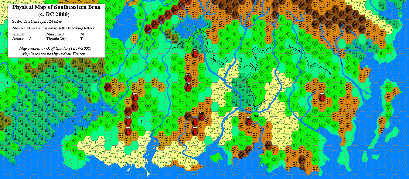
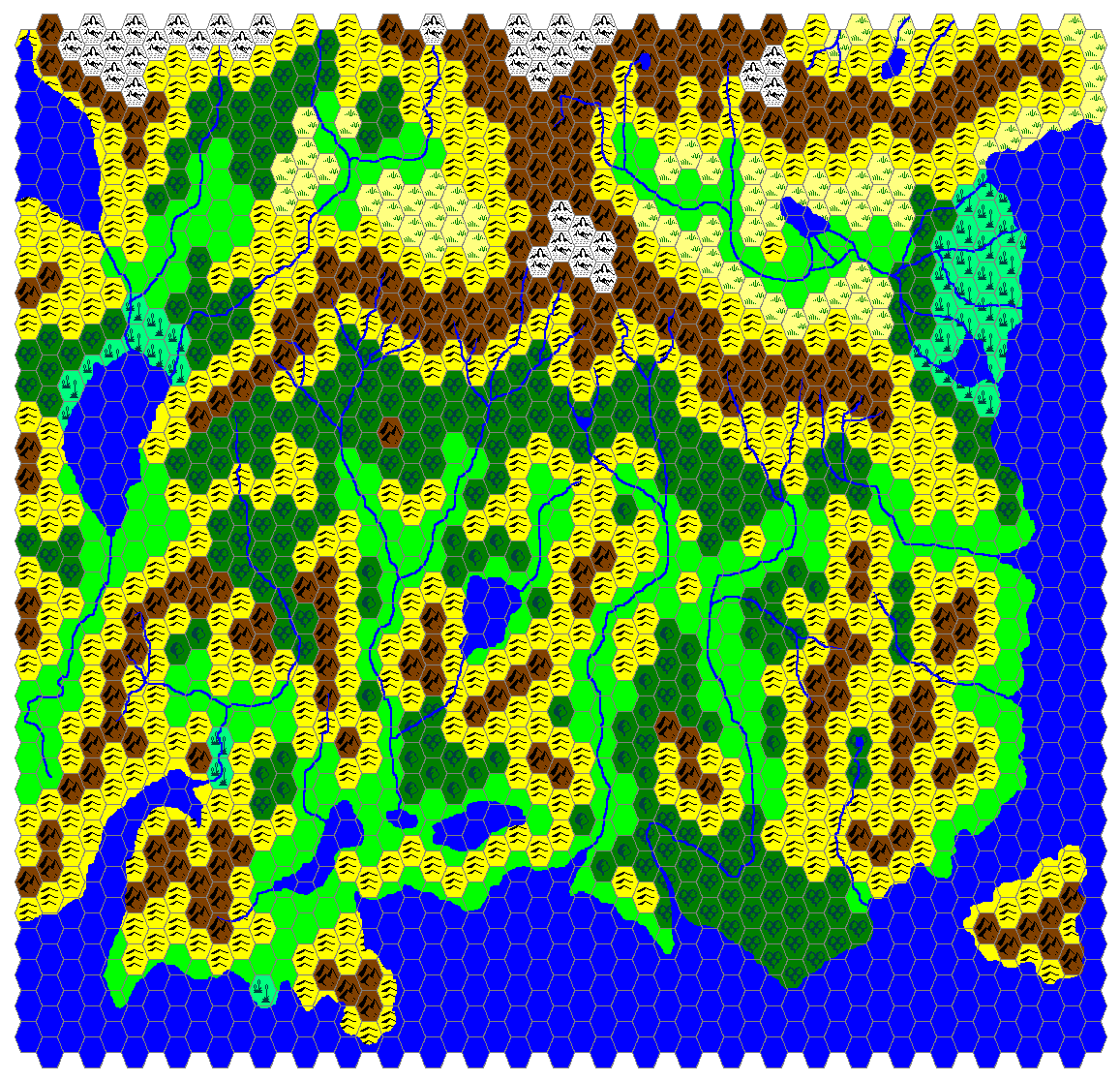
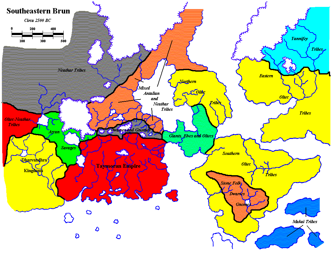
Unofficial Maps: Taymor at the Vaults of Pandius, Physical Map of Southeastern Brun (c. BC 2000) (2002) by Geoff Gander, Map of Taymora (2003) by James Mishler, Map of Southeastern Brun: 2500 BC (2003) by James Mishler, Geopolitical map of Taymora (2004) by Giampaolo Agosta, Taymora BC 2300 by John Calvin, Taymora BC 2300 with cities by John Calvin.
Notes on Taymora
To Do List
- Continue to name all major geographical features.
References
Thanks to: Thorfinn Tait, for providing some wonderful graphics to use in all of our mapping projects. Thanks also to Havard, Hugin, Geoff Gander, DaveL, and Sturm for contributing to the discussions and helping with the development of this map.