
Musings on Map Symbols
by AshtagonFor this discussion, when I describe a hex as "open", I mean that there is no symbol to specify the terrain. For example, the most common terrain type in the central Darokin Streel Valley area is "open green".
Ideally, there should be a 1:1 relationship between map symbols and terrain types.
Both the background colour of the hex and the symbol should convey the same information independently of each other. This is because sometimes, the terrain symbol gets replaced with a feature symbol (ie villages and towns), which can effectively hide the base terrain. (Is that castle sitting in some light forest, or just regular open plains?)
Of the current terrain types that have no symbol, in the most recent legend from Thorf, only the following are open:
- open green: Used for farmland, and "good" grasslands. This evolved from the original "open white" from early editions, when it basically meant "this terrain will not slow down the party's overland movement rate". A lot of terrain types have since been split out from this, but it remains ambiguous between agricultural land, farmland, and (very) light forest.
- open water (in various shades of blue): There's no particular need to add a terrain symbol for this.
- open moss green: It's really unclear what this is meant to be as distinct from the "moss green grass with dotted background".
- solid rock grey: This isn't really distinct from "open rock grey", but there's no particular cause for concern here.
- tl;dr for this list: "open green" and "open moss green" are ambiguous.
Forest Shades: There is a split between light/heavy/forested hills here, and this is a useful distinction. The main concern I have is that the background colour is lacks disambiguation value. Light forest and open green look the same once you put a feature symbol on the map, and at a casual glance, open green and forested hill green are really hard to distinguish. I would increase the difference between these three background colours, and possibly add one more (so that light forest has a unique background colour).
Forest Symbols: There is currently a boreal-evergreen/temperate-deciduous/jungle split here (plus saguaro-cactus, giant fungus, and dead-deciduous). This is good as far as it goes, but is far from complete.
- Pine, regular forest, and jungle use the same colours. This is not a big issue, although I admit to being very partial to Worldographers symbols and colours for jungle.
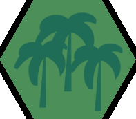
- Thorf's jungle symbol is a palm tree, of the kind most typically found in oases and Mediterranean climates. I understand the legacy value of this symbol. However although it is found in actual tropical rainforests, it is far from dominant, and doesn't really give a good representation for rainforests. This ambiguity is probably because the symbol originally did double duty to mark both jungle and oases, and in the core KW area, there are oases, but no jungles.
- I don't think there's much need for dead/blasted versions of jungle or pine.
- It would be nice to have a symbol for Devonian fungus tree forests (image). These were essentially a prehistoric fungus which looked nothing like any modern tree (or fungus).
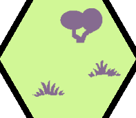
The "Badlands" symbol: There is a RW terrain type called badlands, but the one KW area that uses this terrain type on the map (Red Orcland) isn't that. Based on the GAZ10 description, it actually described "dry scrub land" (image, image, image). There's no good reason not to use the standard grass symbol with these colours to symbolise this kind of dry scrub land.
The "Broken Lands" symbol: Based on descriptive text, this icon correctly describes what in RW terms is called "badlands". Yes, there is a legacy terrain type called badlands, and this will cause confusion. Nonetheless, I would suggest we try to consistently label this as badlands going forwards, so that the maps can be more easily related to RW descriptions of terrain. (There is no RW terrain type called "broken land" to my knoweledge.)
Wetlands:
The earliest versions of map legends had just a single symbol for wetlands, typically labelled "swamp". Real world wetlands are so much more complicated than that.
Mire: This is a catch-all term that includes bogs, fens, swamps, and marshes.
A bog obtains most of its water from rainfall, which contrasts with a fen, which gets most of its water from groundwater or rainwater. Because of this, fens tend to be found on land that is very close to sea level. Although there are other differences between them too (acidity, type of plant life, tendency to form peat, etc.), for most gaming purposes, there is no real difference, and they can use the same symbol.
Swamps and marshes, however, have a major difference. A swamp is capable of supporting trees and shrubs, whereas a marsh is limited to herbaceous plant-life (grasses, basically). In more recent artwork, this difference has been noted in the symbol. However, the colours leave the two really hard to distinguish.
It may also be useful to have a separate "tropical swamp" symbol; the deciduous tree looks very out of place as a symbol for a mangrove forest (which despite the name, is a type of swamp).
Warm Dry Lands:
There are a few "missing" terrain types that could justifiably have their own symbols.
Mediterranean scrub land: This is a fairly mixed terrain type, and currently seems to be drawn with any of "yellow grass", "open green", "green grass", or "light forest". It almost certainly justifies its own terrain symbol though.
Savannah: This is essentially a hot dry forest (image). For a variety of ecological reasons, it tends to only be found in "light" forms.
Mountains:
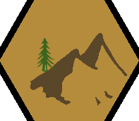
Some map legends include various kinds of "forested mountain" terrain. I'm uncertain whether this is needed, but I am open to having that as an extra item in the palette. It may also be useful to distinguish mere mountains from very high mountains. Thorf's palette has hinted at this with different background colours for "mountain" and "mountain ridge", but the two are hard to distinguish at a casual glance, so a different icon may be useful.
Colour Palette Shifts:
For my own maps, I've created white (actually very pale blue) background versions of pine forest, hills, mountains, and grass.
Dead/Blasted versions of most terrain types would definitely be useful. This can symbolise an Aengmor-like situation, but also any kind of magical (or nuclear) devastation.
Regarding the "open green" hexes, my preference is to consider them to be fertile grasslands by default (ie a really flat version of "ghibli hills"); actual farmland that is independent of a settlement should normally be the exception, and can be marked by the farm symbol on top of any type of terrain. This is part of a design philosophy that would have the base terrain types mark natural features, and artificial terrain created by sentient life marked by symbols rather than terrain. This allows them to remain "unmarked" by default, avoiding map clutter. In a hypothetical map with advanced industrial scale agriculture, we might have to make the opposite assumption, that "open green" marks farms, and "green grass" marks the opposite case.
(the "open moss green" vs. "moss green grass" has a similar dichotomy, but for the moment I want to focus on overland terrain types.)
----
Worldographer's (hereafter WG, because that's too long to type) forest shades are a bit garish, I agree. But there has to be a middle ground between garish and hard to distinguish.
----
I'm not too sure how a mixed forest symbol could be made to be honest. For forested hills and light forest versions, it would require two trees (which would then make all the other forest symbols look odd by comparison); or a weird split-down-the-middle tree. I'm happy enough without it.
For "giant" versions of trees (elven giant home trees, giant sequoia trees, and any fantasy variants of these or others), the default tree type in a darker shade would work, similar to how GAZ5 did the home trees.
Here's WG's jungle symbol, in their colours.
I think having that deeper green works for jungle in a way that helps distinguish it from colder types of forest terrain. The artwork also has broader leaves. It is subtle, but it conveys the sense of a rainforest more than the legacy artwork.
----
That Chinle Badlands (image) is actually the exact type of terrain that "legacy broken lands" should refer to - lacking in fertility or even much topsoil, with wildly uneven variations in altitude at a local level. In contrast, if you look at the links I used upthread to identify dry scrubland (ie legacy badlands), you'll notice the sparse green vegetation and orangey-red soil (especially on the Australian outback one). Could this be solved by renaming the current Badlands to Scrublands (a hex we�re otherwise missing, and which it does resemble with its sparse vegetation), and changing Broken Lands to Broken Lands/Badlands? This is exactly my sentiment.
"Broken Lands" can be renamed "Badlands (Legacy Broken Lands)" with no loss of information. Equally,
"Badlands" can be renamed "Dry Scrubland (Legacy Badlands)" with no loss of information.
----
Regarding wetlands, I'm happy with just a marsh (no tree)/swamp (with tree) distinction. Since most of the subtle distinctions involving bogs, fens, mires, and other wetland stems are to do with peat-forming, acidity, water source, and other aspects that aren't relevant to adventuring, I'm not sure that more than these two terrain types are needed for wetlands at a general level. In essence, the key aspects are 1) is it permanently wet underfoot, and 2) are there trees or other tall vegetation that can force changes in direction over short distances?
The distinction between the two can probably be accomplished by using the moor/bog colours with the swamp (ie with tree) symbol for swamps.
Mangrove forest/swamp can then be a variant of swamp symbol, with a mangrove tree replacing the deciduous tree.
There is currently a fen hex (swamp colours with grass symbol), but this isn't really a distinct terrain type separate from marshes. It doesn't really justify its own position in the map legend. The most well-known historical fens, in what is now Cambridgeshire, were really just marshes.
----
Mediterranean scrub: As I noted earlier, it has been described with all kinds of terrain symbols. I suspect a lot of the land around the Savage Coast Ispan baronies would be this terrain type if it had its own hex symbol. I'm not sure your symbol in that Narwan map does the terrain type justice though - it really is a lot greener than that. My main annoyance with this terrain type is that it lacks a name that is separate from the RW sea, which creates an annoying break from immersion in fantasy (non-Earth) maps.
I cheerfully admit that my Mediterranean scrub icon (a mash-up of WG and Thorf artwork, with the foreground colour taken from the standard colour from climatologist maps for that terrain type) is ugly as sin, but it's the best i have to work with for now.
----
Savannah: I agree that there is a legacy issue here. The "yellow grass" hex art has previously been used to refer to both steppeland (a la Ethengar), which is a notably cold biome, and to savannahs, which is a notably hot biome. The fact that the two biomes are so different in itself justifies having distinct artwork for the two terrain types.
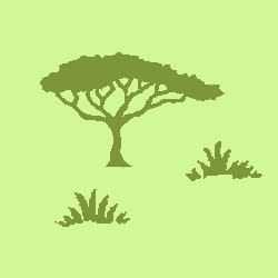
Once again, here's a mock-up of my current savannah icon, a mash-up of WG and Thorf artwork, with WG colours.
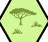
Note that it has the same warm green background colour. It seems to work well to convey the warm temperatures.
----
Here's a quick mock-up of what "pine-forested mountains" might look like. No, I'm not happy with it either.
----
"Cold" palette shift
Here's my glacier icon. Note that I made the horizontal lines much thinner. It still conveys the sense, without overpowering the main "broken lands" icon or the background "offwhite".
One extra thought on using the "yellow grass" symbol to indicate savannah terrain: It's not even factually correct to do so. It's an error on a par with the badlands/broken lands/dry scrub issue noted earlier. Why? Because the literal definition of savannah terrain in the real world is light forest cover that does not have a solid tree canopy. For historical and linguistic reasons, it traditionally refers specifically to hot dry light forest, but technically, it could refer to any kind of light forest (although you'd be a bit of a prat to call light boreal evergreen forest a savannah, even if it's technically correct). So using the "yellow grass" hex art piece to include both steppe and savannah, when there is an actual light forest hex art, is just really bad planning (or possibly the original writers weren't fully familiar with what savannah actually means).
That "yellow grass" map symbol
This is labelled as "grassland, steppes, savanna, or veldt". But what do those terms actually mean? And how is the symbol used in Mystara?
In terms of actual usage within the core KW Gazetteer area, it was used exclusively in Ethengar (where is symbolises Mongolian style steppes) and the Atruaghin plateau, where it was used to describe land similar to the Great Plains region of North America. So the grassland and steppe concept seems fairly straightforward.
Savanna(h), though.... The actual definition of savannah as a geographical term in the broad sense refers to any light forest that lacks solid canopy cover. Which makes using the symbol for such terrain kind of redundant, seeing as how there is an actual light forest symbol (two actually). In the strict sense however, savannah tends to refer specifically to hot dry forests, such as that in Tarangire National Park, Tanzania. I strongly feel that such "hot dry forest" terrain should be separated out from the "yellow grass" terrain, as a) such terrain is technically a type of light forest rather than being truly open grass, b) there is precedent for separating out forested terrain from open terrain
And veld(t).... It's an Afrikaans / South African term that describes a large region in the northeast of the country, and doesn't truly refer to a single terrain type. Here's some pictures of various parts of the South African veldt, to illustrate
(image) would probably be best described with the "clear green" hex art.
(image) justifies the "yellow grass" hex art (at least, the foreground does).
(image) It's hard to be sure from the distance, but the background area might justifiably be called heavy forest.
(image) looks a like like Mediterranean scrubland.
(image) another area that justifies the Mediterranean scrubland label.
(image) still part of the veldt region, this is basically badlands (ie legacy broken lands).
Essentially, there is no such terrain type as "veldt". Calling "veldt" a terrain type is like calling "Appalachian" a terrain type. It's a region, dominated by certain terrain types, but by no means so exclusively one type that it can be considered synonymous with that type. We are better off pretending that "veldt" was never part of that label. Fortunately for map-making purposes, there was never a M-South-Africa written, so the veldt label was always redundant.
However, one take from this is to note that the Mediterranean scrubland biome (and its South African cousin, bushveldt) should have its own symbol. Other areas of the RW where this terrain type is found include California, mid-latitude Chile, and south coastal Australia. While it lacks the tree cover of even "light forest" (although it may have a few trees dotted around), it is notably much more fertile than steppes, which aren't generally capable of growing much more than grasses. This fertility has important consequences should the PCs enter the nation-building stage of a campaign.
My other take from this is that we need some hex art for savannah in the strict sense (ie hot dry forests). I've attached below my two symbols for shrubland and hot dry forest, but I'm not truly happy with either, and would welcome better art for them.

Certainly, the definition of savannah does vary depending on who you ask. I earlier noted two major types of use - one in a strict sense to refer to hot dry forest with broken treetop canopy coverage; a second to refer to any forest with broken treetop canopy coverage. It occurs to me there is also a third, which refers to any forest with broken treetop canopy coverage and substantial grass coverage. @wingofcoot, I suspect it is this third definition that you use.
Practically speaking, it an area where the forest cover is broken enough to justify calling it a savannah under the second definition, it would be extremely unlikely for grass not to be growing in the gaps; the only thing that really stops grass growing in a lightly forested area is the presence of trees taking up all the available direct sunlight. In essence, if a forest is dense enough for grass not to grow, it's a heavy forest, not a light forest/savannah. (image) is an example of such a light conifer forest; (image, select first image) is another. It does seem to to be less common that dense conifer forest though.
Etymologically, savannah comes from Spanish sabana, which in turn comes from the Taino language. The Taino language family spans most of the Caribbean islands, with the "classic" forms spoken in Puerto Rico and Hispaniola. This is perhaps why it traditionally refers to hot dry forests-grassland ecosystems; because that is what mostly exists there when discussing tree-based ecosystems. Given the ambiguity in the word savannah, however, I'm happy to refer to this terrain type by the less poetic "tropical dry forest" until something better is found.