
Pre-cataclysm Mystara
by AshtagonI've been playing around with rotating various maps of Mystara, in order to find the old north pole. I'm working with the theory that the old north pole was located in what is now the Sylvan Realm. This gives Ilsundal a specific reason to choose that site, as it could logically has magical energies left over from when the Immortals filled in the old polar hole to the Hollow World.
The downside to this position is that it makes the Borean Valley somewhere between on and inside the Arctic Circle, which is entirely too cold to be a reasonable place for Hel to have placed the beastmen. I'm assuming here that the intent is that the Borea be a river with actual moving water, not just a glacial valley. The logical fix would be to make the north pole about 5-10° off the coast instead of having it sited on the Sylvan-Realm-to-be.
Map A
Re-projection of HW map:
(-90e -45n oblique plate caree)
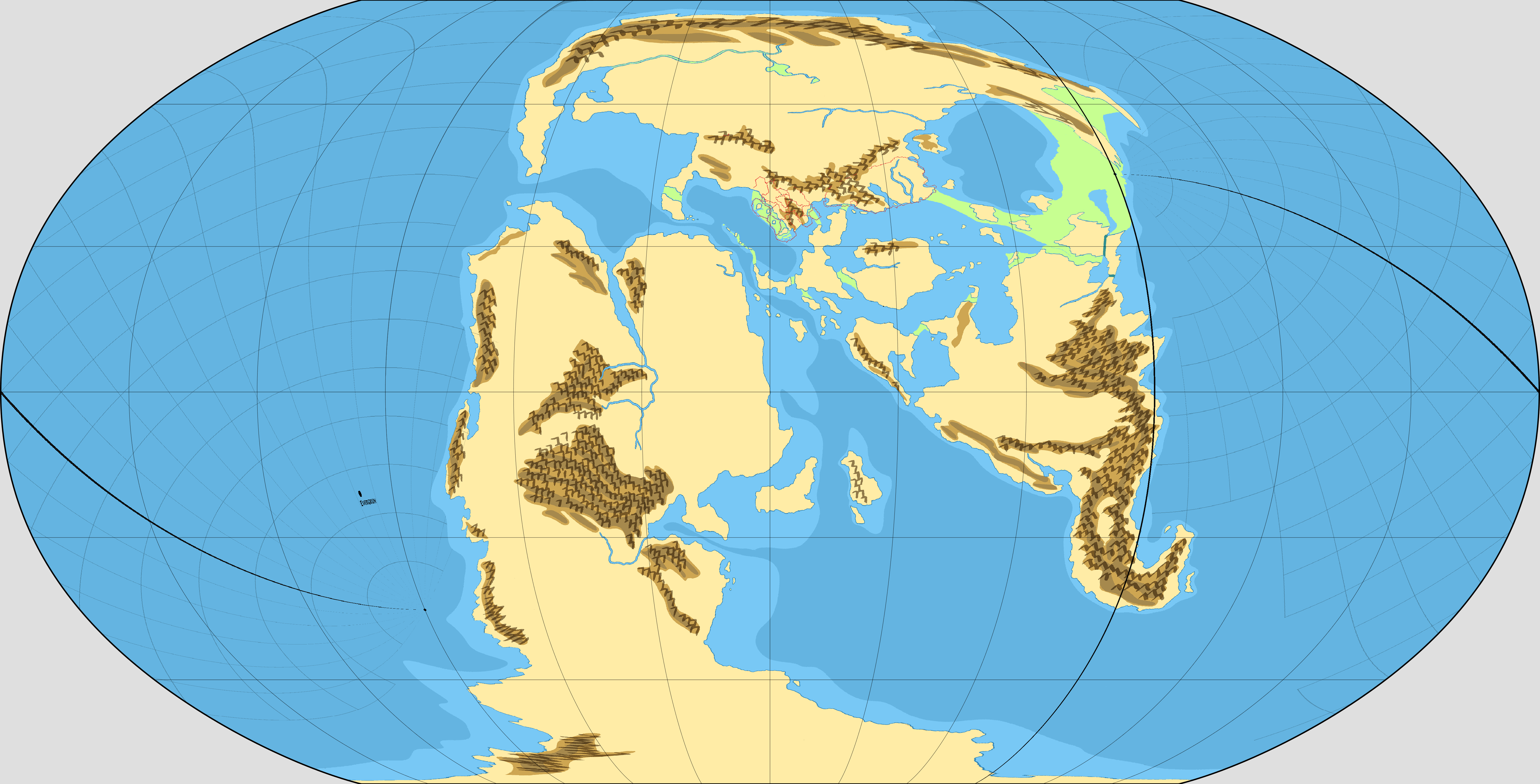
Map B
Re-projection of Thorf's map:
(-80e -60n oblique plate caree)
Map C
Re-projection of Thorf's map:
(-90e -45n oblique plate caree)
Additional observation: Yalu bay would be permanently frozen. It is questionable whether the Yalu Sea and Yalu River could even exist at this point in time, given their latitude and therefore lack of liquid water. Yalu Lake is basically at the same latitude as central Greenland. The ice will be a few dozen feet thick, minimum (and probably more like a mile deep)
Map C, which has the north pole off the coast, moves the Borea Valley to below the Arctic Circle. It's still going to be cold. With the continental effects and latitude, imagine Lake Baikal and northern Mongolia. It's definitely frozen in winter, but flowing in summer.
In all cases, the actual north pole will be under a deep layer of ice, whether it is on land or at sea; ditto for the south pole. Given the polar openings to the HW at this time are supposed to be quite small, it is unclear to what extent they would even be navigable. This would probably be a case of skis, sleds, or sled-mounted ships. The weather is almost certainly not conducive to skyships, especially if the opening is small (Haldemar and the Princess Ark reportedly had trouble with the much wider modern era openings).
Here's the map re-projected to show Ethengar as the north pole.
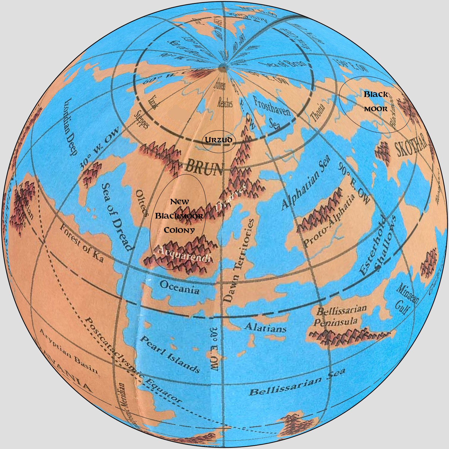
With this version, Nentsun-based Blackmoor is still temperate. The beastmen wouldn't have lasted a week in the permanently frozen Borea Valley (think central Greenland for climate). And canonically, the Blackmoor crusades drove them north to Hyperborea, which in this version of events, is due south from the Borea Valley. This version also makes the New Blackmoor Colony fanon basically impossible in the location it was placed, although other locations are of course possible. It would also render the Oltec-Azca backstory impossible, as canonically, they had a civilisation in the Sind-Great-Waste region at the same time Blackmoor was thriving.
(nb I've edited a base map a bit to remove some of the "modern" labels, and add some of the "lost land" which is drawn in light green.)
Map D
Re-projection of Thorf's map:
(-27e -58n oblique plate caree)
I actually think Map C is the intended transformation from when the HW box set was written. It is, mathematically speaking, the simplest possible transformation that even vaguely resembles what was drawn in the HW box set maps, and as any cartography to be done at the time would have necessarily been hand-drawn, that would have been an important criterion.
Because people no doubt want it...
Map E
Robinson Projection, based on Map C
("simple" 45° rotation as previously noted)

For my purposes, I am de-canonising the pre-cataclysm HW box set map. At best, it is the work of that famously incompetent Thyatian geographer, Scipio Borgia of Retebius, who also invented "Thar's Manual of Good Conduct" out of whole cloth, and had some rather peculiar ideas about what daily life is like in the nearby Kingdom of Ierendi (some Ierendi businessmen would later try to capitalise on that reputation created by his guide, so in a way, Scipio can be blamed-thanked for kick-starting the Ierendian tourism industry). I'm basically going with the 45° rotation as my headcanon. Fortunately, that is also close enough to Sturm's 72-mile hex world map that broad strokes geographical features (at a small continental level anyway) can be copied over. So I just need to figure out a way of "tracing" over those map details from the Sturm hex map to get the land bridge done.
Regarding the Blackmoorian transport systems and technology...
I'm dropping the idea of the land bridges being Blaackmoorian engineering works.
I like the idea of Blackmoorian magitech being kickstarted by the crashed Beagle. I imagine Blackmoor in 3050BC as being basically magi-steampunk, something like old TSR's Magitech setting, but set in 1880 rather than 1990, and without the focus on bio-necromancy that setting had (that particular piece of magical engineering made the setting very dark when you considered all the unfortunate implications). The 3000 BC disaster could potentially have been triggered by an early spaceship launch. I'm not a fan of Blackmoor having a functioning space empire, as any space colony that was at all self-sustaining would certainly have re-colonised Mystara. They may have had satellites, but it's questionable how much reason they would have had to try to do that, given they have magic available too.
So, civilians basically hire passage on ships, use the *maglev, and may have a personal autocar of some description if wealthy, or use horses and carts if not. The military (and government diplomats too I guess) has regular ships, skyships, and probably has use of military-only *maglev lines. The ultra-wealthy may have personal skyships.
The problem here is... how does New Blackmoor maintain contact with Thonian Blackmoor other than military-diplomatic skyship? Communications can be done by sending spells and similar magic. Teleportation isn't really a thing for Blackmoor, and wouldn't sustain a colonising effort. We can suppose that, by imperial/colonial times, Thonian Blackmoor has an oceangoing harbour on the south coast of the Blackmoor land bridge, allowing easy ship access to Alphatia, Bellisaria, and the northeast coast of the Isle of Dawn. But unless there is an analogue of the "modern" cities of East and West Portage in 3050 BC, it's still a really long sea journey to New Blackmoor. There are secondary possibilities for a Portage-analogue (or Panama analogue) to be present on the land bridges along the Dawn-Ochalea-Adhuzia chain if the Isle of Dawn route isn't possible. Although that wouldn't save nearly as much on journey times, it would still be useful if the engineering feat isn't too big.
The other problem with having seagoing transport being the main means of contact between New Blackmoor and Thonian Blackmoor is that, as drawn, the New Blackmoor map seems to lack a mainland oceangoing port that is also connected to the radiance lines. Tudaka is probably the nearest to that, but for such an important transit point, I would have expected more links; perhaps the Dawncity-Southfall line should be changed to Dawncity-Tudaka. Southfall appears to be inland, so wouldn't really work for this purpose.
What are Blackmoor relations like with the Ghaudar Empire? There would need to be good relations for a Portage-analogue to even be possible.
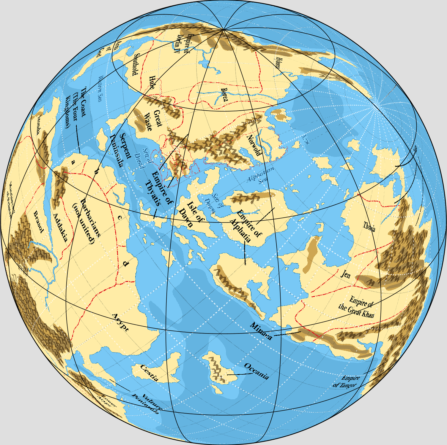
Revised world map uploaded. I have corrected the position of the Black Sea and the Skandaharian Sea.
Map F
Some observations...
The southern Sea of Dread (south of the Ochalea-Adhuzia chain) and related bodies of water along that east-west route are going to have some monster tidal waves and ocean currents. The entire planetary mass is shaped something like a giant Tokyo Bay with a tiny opening to the west.
Blackmoorian sailors would almost certainly not use the M-Pacific route to reach Evergrun, as there are no points to act as stopovers. Additionally, the lack of a similarly-sized Atlantic Ocean analogue means there aren't any stepping stones for development of very large ocean-going ships. The southeast southern coast of Skothar and the northeast coast of Grunland sort of meet that criteria, but there are no major civilisations based on either location.
New Blackmoor is located almost exactly halfway between Blackmoor and Evergrun, and being on the north coast of the Sea of Dread, it is sheltered from the monster tides mentioned earlier. It is almost certainly a stopover port for transport between the two core regions.
The Bellissaria-Alphatia channel is very likely another major stopover point (which coast would depend on a more thorough climate analysis). The west coast of Izonda (M-Peru) probabluy acts as a third major stopover region. This area is likely a part of the elven civilisation.