
in a veritable Myoshima frenzy, I'm opening yet another thread, to show you the map I've drawn, based in part on Arcanda's previous map (I've tinkered heavily with the distances, though, to have it conform to the surface proposed in the Patera Project).
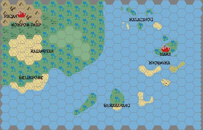
Map of Mysohima
by Giampaolo AgostaIt's 24 miles/hex, so I couldn't put too much detail:
![]()
Now, what's on the map:
Cities: apart from the capitol, Mara (a veritable metropolis, on par with Thyatis), we've got 3 (much smaller) imperial cities:
- Byakkyo: founded less than one century ago as the new capitol, it fell afoul of a curse and was abandoned less than a year after the court moved there. It is now inhabited by priests trying to contain the curse, and those inhabitants who are too poor to relocate.
- Kamakura: siege of the ancient Kamakura shoguns, it was partially destroyed when the last Kamakura shogun was dethroned. Emperor Hirameki took control of the city at the foundation of the empire, and never allowed it to be assigned to vassals.
- Minato: an harbour town founded after the end of the Myoshiman isolation to host the fleet that would support the (failed) invasion of Selimpore.
The towns marked on the map are the provincial capitols of the thirteen largest provinces. There are 20-odd smaller province, but it's impossible to mark them all (also, I haven't designed or even named most of those yet).