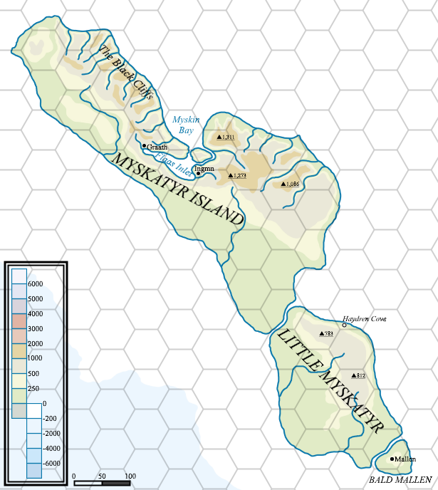
Atlas style map of Myskatyr Island
by Mark HowardThis is something I've been thinking about for a while, a more real world "atlas" style map.
I'm still working on a few ideas about how I want to portray some information, and generally how to do maps like this, but here is a draft of Myskatyr Island, sat off the north-western coast of Thonia.
A large island, but the gently sloping land on the west of the island is largely uninhabited due to the harsh weather and thin soils, less than a thousand semi-nomadic tribesmen call this land home. The eastern side is dominated by the steep Black Cliffs that rise steeply from the coast, a legacy of the earthquakes that took place at the fall of Blackmoor. Several fast flowing rivers tumble over these cliffs. A couple of small villages sit on the shores of the large inlet, gaining some shelter from the harsh weather. A few small-holdings dot the coast here as well.