
Islands of the Thanegioth Archipelago
by RobinThis is one of the Oldest D&D maps I have ever made which still survived
I rediscovered these recently, taped together as a whole
They are based on canon, yet also differ from it, as Cathos/Vacros seem to be placed elsewhere following later canon
From west to east (I had taped these together) and the compas you see on the sides is wrong and originates from the original copy,( and was covered in the overlap of the maps taped together)
The water markings I created myself are easily distinguishable; Whale, Fish, Kelp, and , the black close-curls are reefs, red triangles volcanoes, the blue lines altituds/depth. Symbols looking like strange octopi, are floating forested rock sections of a few hundred yards pushed up by giant geysers ...these I took from a SF comic---(I have to check if I can recover which, )
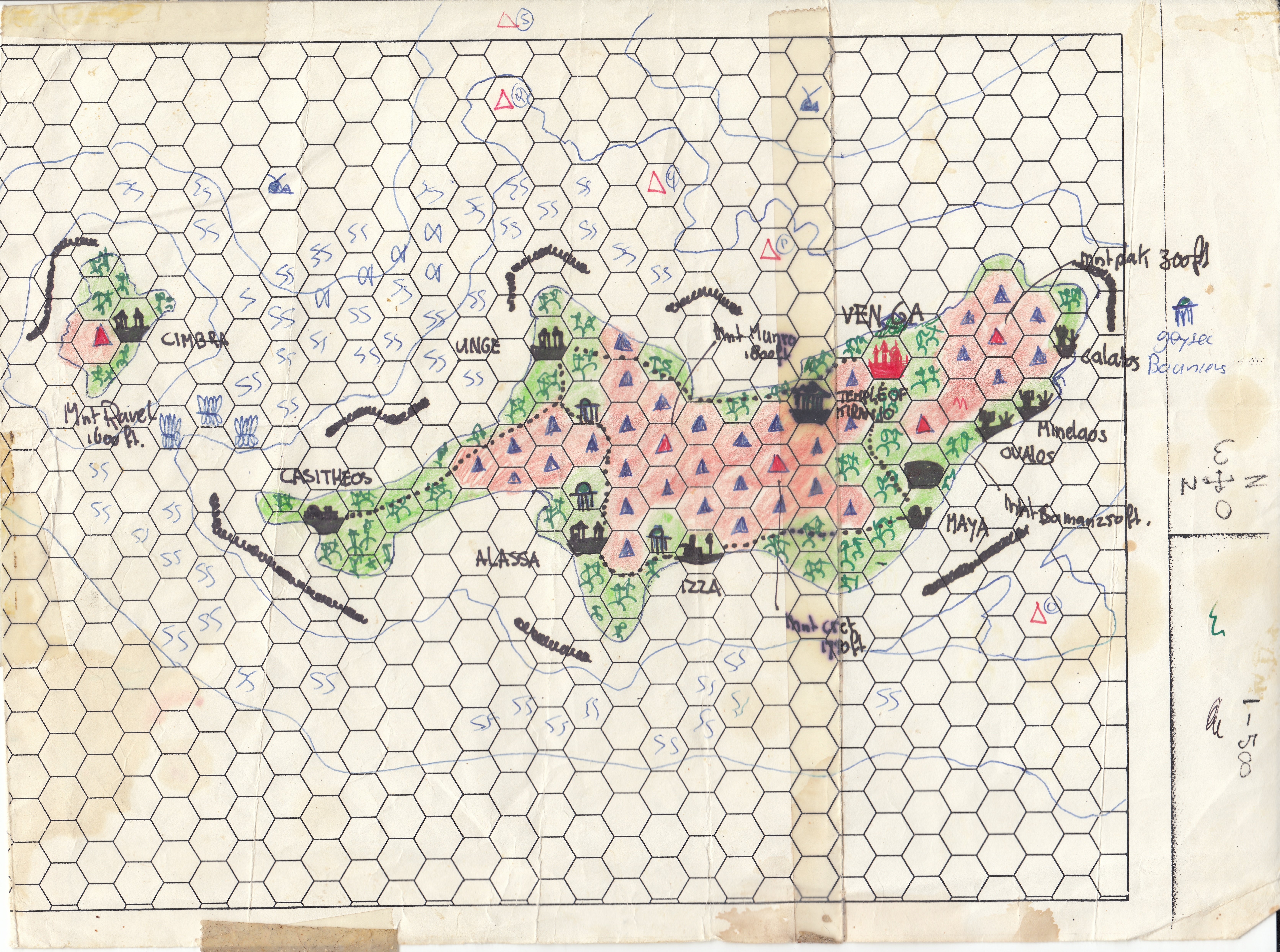
Venga;ĀĀNation of native clerics, flying monkeys (Tabi's, yet I did not know by then, I based these on Alice in Wonderland) and weird floating Geyser islands high in the Sky. It is also populated by Dinosaurs migrated from the Isle of Dread. The weird Island is originating from the 1955-1970 Dan Dare comics, of which in 1979 I acquired a Dragon's Dream copy to keep. The geyser island is wondersome to behold and after a reread of said book I added it to this island. Thusfar the only copy I could find online is hereĀyet I'll try to scan the better original and share that better option later
Venga -Isle of Dread overlap;ĀĀThis section details the location as to the famous Isle of Dread, as well as displays the geological fault line for the major volcano of the island.
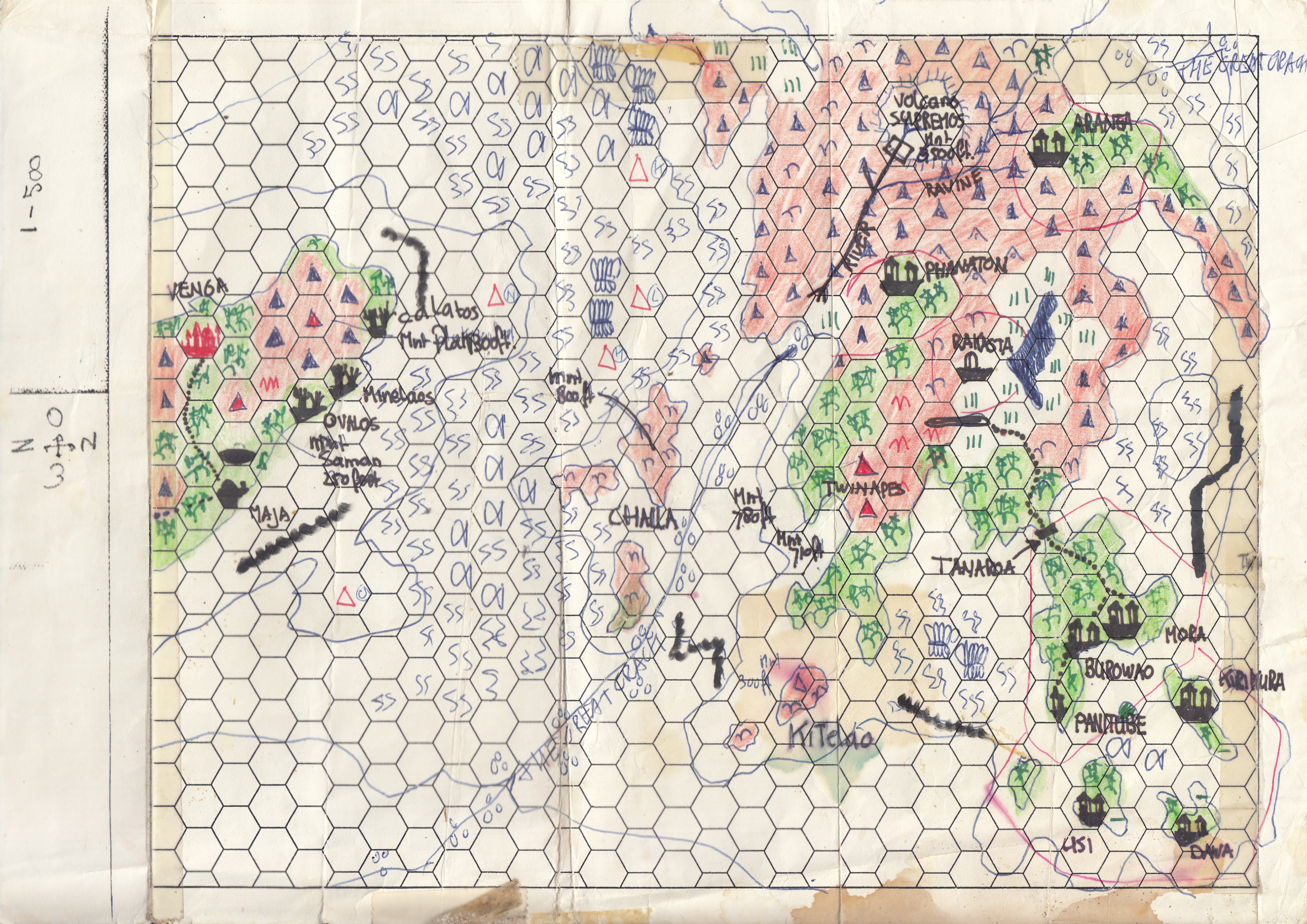
Isle of Dread -Parkinos overlap;ĀThis is the west overlap to the famous Isle of Dread and reveals the Isle of Parkinos, a friendly islands owned by the nation of Vacros. It is populated by Natives.
I have A Twaelar Citadel and other settlements in the waters, this I created after receiving some information on this underwater race (sorry I really don't know where anymore), even before PC3 The Sea People was released. As such It digresses much from the later canon, I think I had read some inside information by an author on a Gencon.
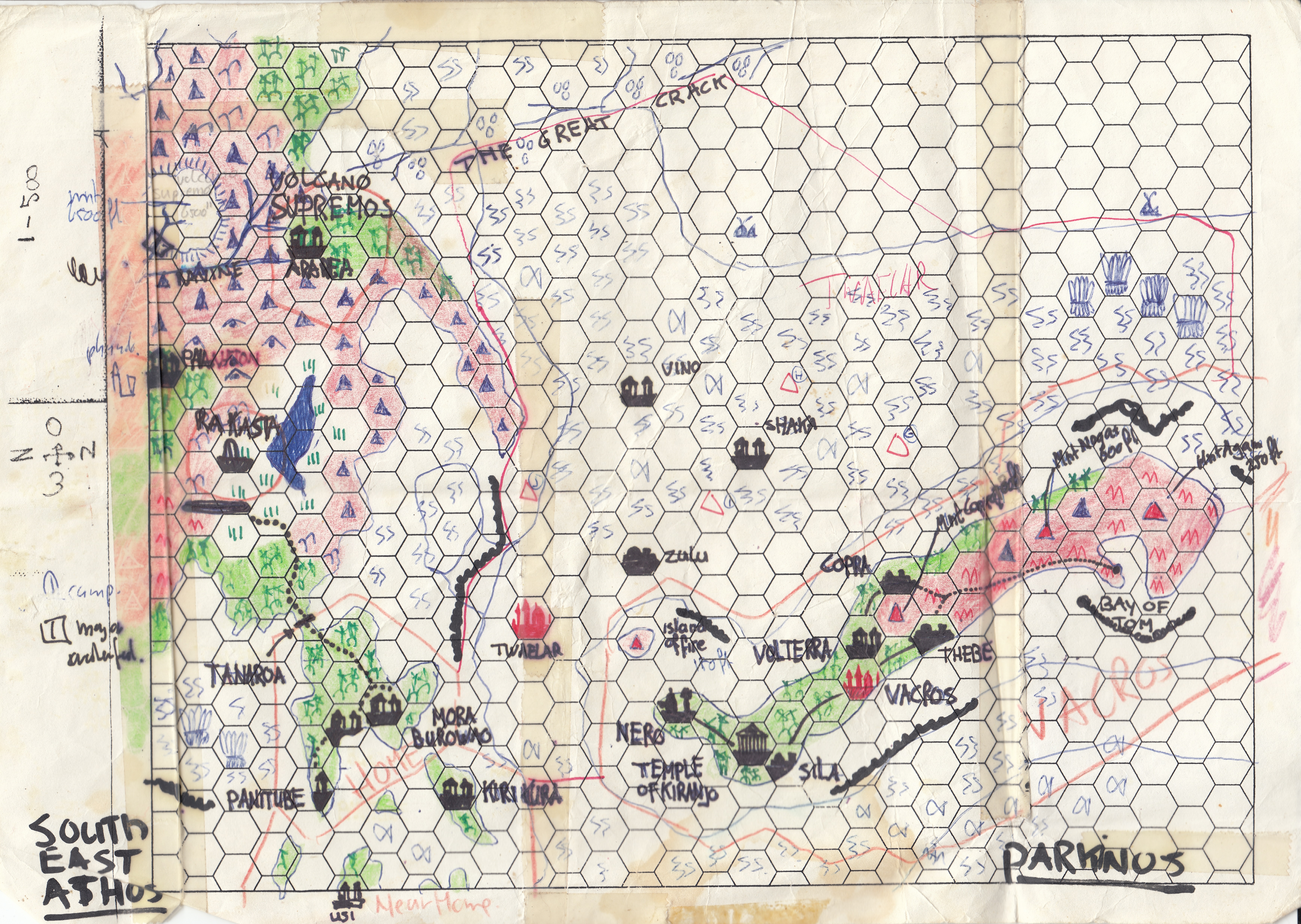
Parkinos-Vacros-Thanatos;ĀĀVacros is the island on which adventure M2-TSR9060--Maze Of The Riddling Minotaur takes place. The Isle of Thanatos is a wasteland where nothing lives, and only immaterial wraith (undead) roam. The temple of Thanatos lies on the middle of the island, and must be cleansed/consecrated in the name off a good Immortal regularly to prevent the wraith from accumulating and eventually leaving the island. The original Wraiths long perished and were added too by failed consecrating clerics/heroic aids, and no longer exists, except one which has become a wraith lord as perĀTSR 9165 - X11 - Saga of the Shadow Lord. This section detail I created after attending the 1990 Gencon and obtaining a copy of said adventure. This wraith lord can leave the island and visith the archipelago, yet must return every fool moon to keep its powers and not reverting back to a normal wraith.
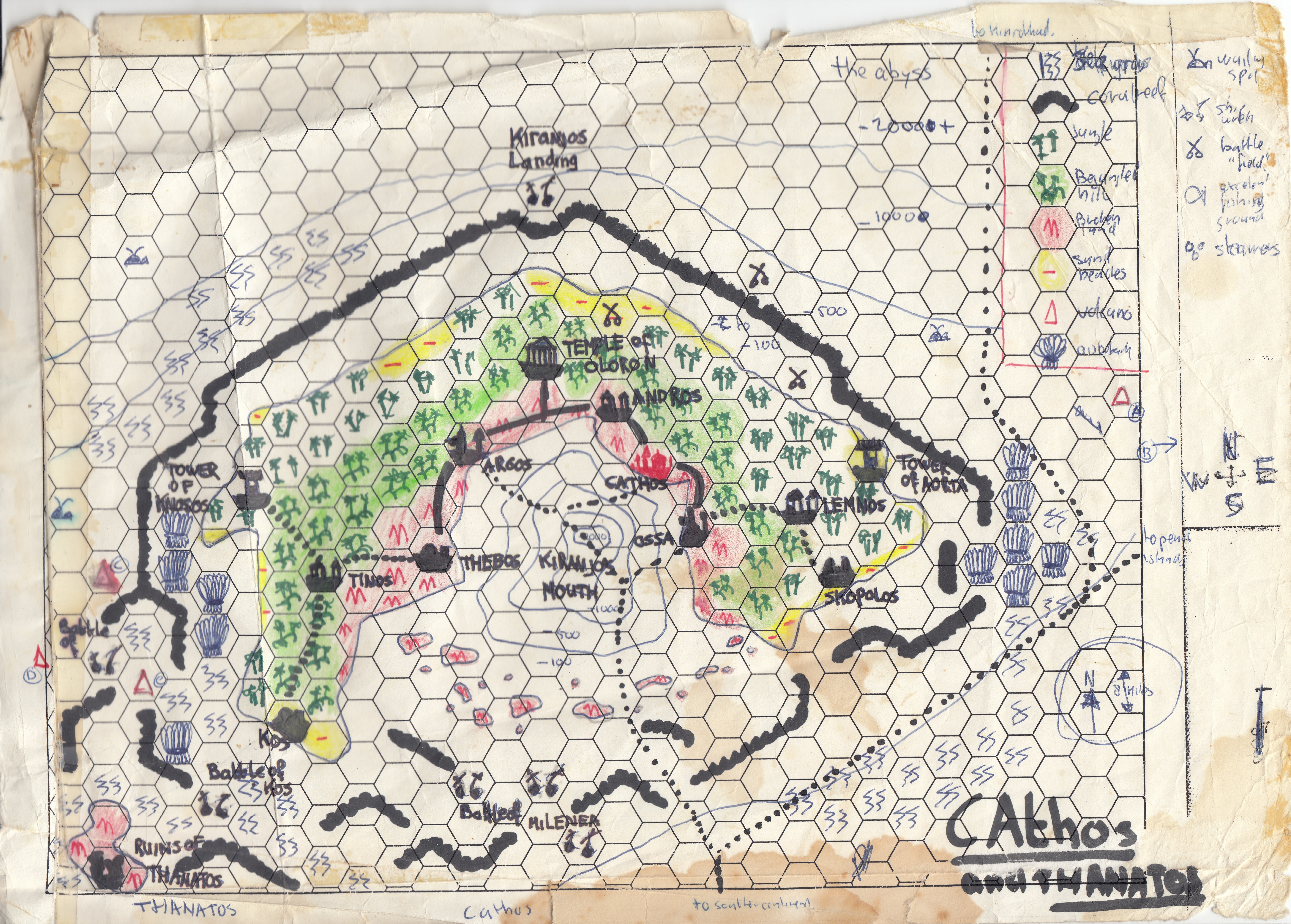
Cathos;Ā
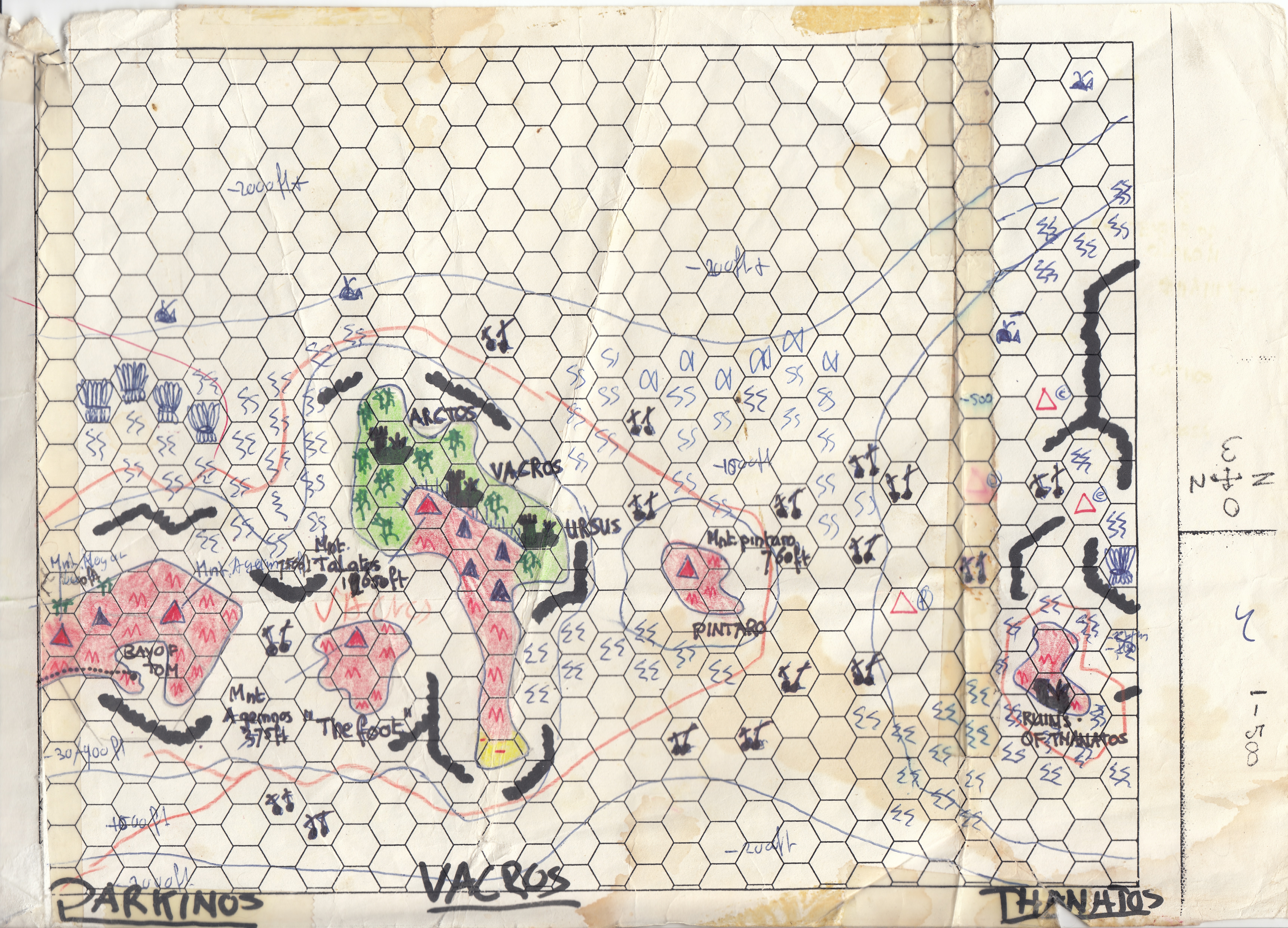
TheĀ other islands from the Isle of Dread Chain (Thanagioth Archipelago) I named after the Cathos/Vacros designations give in adventure;ĀM2-TSR9060--Maze Of The Riddling Minotaur which I did acquire together with Xblue box and the Isle of dread at the moment they were available here in the NL (8-1990) , and I bound these together storywise.Ā
I remember I had later expanded the stories and envisioned a Cathodian Fleet with weapons unheard of in Mystara (based on the Captain Redbeard Comics of DupiusP) making these vessels an awesome opponent to confront, I remember then even Thyatis dared not to meet these. Luckily the Cathodians were not conquerers , just defenders. In my campaign most of the Cathos /Vacros inhabitants were Minotaurs of which the Vacors were transformed to appear humanĀ due a curse. and the Cathos had a terrible fleet of a several copper plated (non connected plates) vessels with multiple arrow shooters (100 per shot), double ballista's (to break masts), diving/underwater ballista's (to damage beneath the water line), greek fire, Grey Ooze Bomb jars and catapults, rams and then the minotaurs themselves and spellcasters....brute...the players of those daus still remember the warnings in the harbours speaking of nor messing with the Cathodian Wargalleys..Not even the Thyatians dared too.
These colored maps are from after august 1983 finished these before the new year.
This map was made on copied hexpaperĀ by ballpoint(Red and Blue), color pencils (Green and Red) thin sharpie marker (black) and a fading yellow bright marker. The compasĀ you see on these is faulty and was drawn on the hex map before making a copy of it and later this map. With taping these together these were covered. The actual compass north is top of the map.
It has been damaged by time and storage a bit, yet is good enough to reveal
Thanks to Thorfinn Tait I got the jolt of support to release it.
The hex Scale is not 6 miles as per X1 Isle of Dread, yet readjusted to 8 mile per hex by the in 1988 research map of the Isle of Dread in 4.3/8th mile per hex
I had seen the differences between the X1 Continental map and Isle of Dread map in the same box, and I rememberedĀ similar flaws existing in B10. So I measured (by hand) and resized everything manually...hence I came to 4.3/8thĀthat was in my opinion then the best scale.
Only recently I learned that this resizing was a canon flawed issue and was resized to 4 miles per hex. Either one works; 6 miles, 4.3/8th mile, or 4 miles.