
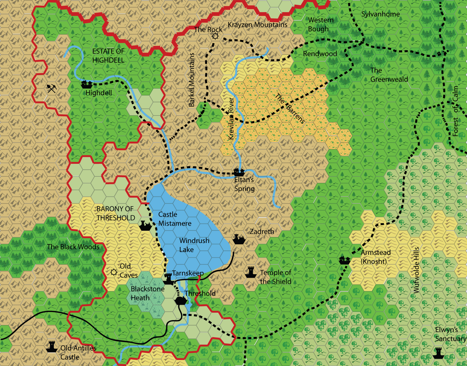
Threshold Area Map
by happylarryBeen working on a 1 mile per hex map of the area Simone mapped in 2.7mile hex 18 months ago. so here it is:
Two comments:
1. mostly I've just scaled up from Simone's map, with the exception of Threshold - where I've used the stuff in this thread, and the rock area - I had a look back at the module when I was doing this map
2. I've added one additional place - Tarnskeep
some thoughts:
1. what else should be on a map of this scale? should things like some of the 'hundreds of homesteads' mentioned on page 6 of Gaz 1 be included? or any staging inns along the main roads etc. Also - what about more localised geographical features - for example, what is the pass through the mountains near Old Antilles Castle called?
2. are the 'traditional' settlement symbols the best here, or would it be better - a little bit like with the rock and the old caves - to use a smaller and perhaps more precise locator?
3. I haven't varied the terrain from the original map, so it does look a little bland at the moment.
all thoughts and observations much appreciated!