
A general map of the trade network
by LoZompatore.Here is another "general" topic with a couple of maps. This time they are focused on trade routes.
In the images below there is a summary of the "global" trade network showed in the maps of the whole (or so) official supplements.
I used the usual "superposition" technique: when two maps show two slightly different trade routes I kept both of them, supposing that they represent two distinct way of moving goods across lands and seas.
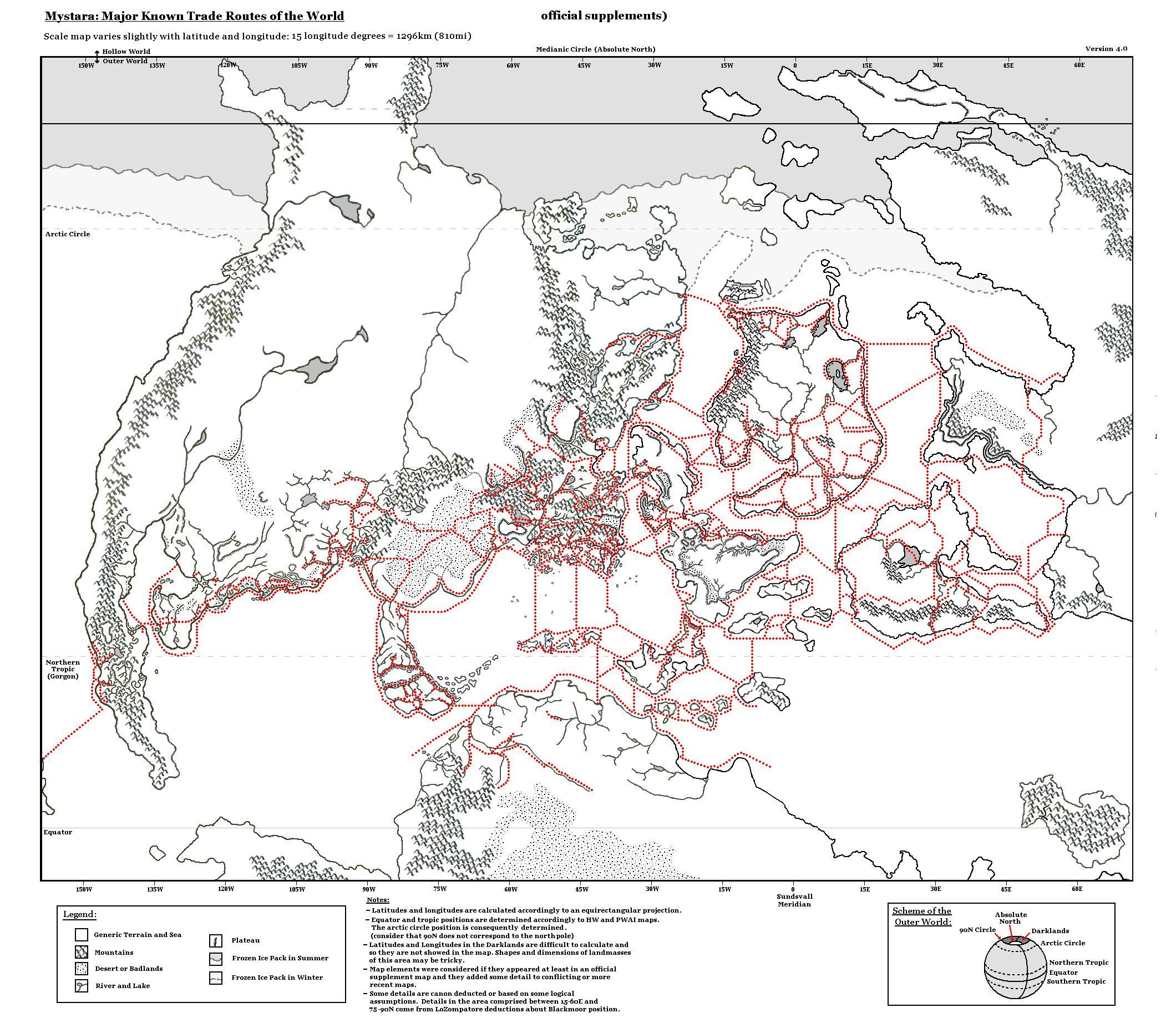
The first map shows the "rough" data, exactly as they are represented in the official maps. (Note: the layout and the style is not very refined: consider the picture as just a "data archive" about the official trade network). The image below is in low definition, the hi-def map may be downloaded in the link below:
The second map is a little bit more refined than the map above: among the modifications I made I extended the interrupted sea routes to faraway lands (Cestia, the Jungle Coast and possibly the western coast of Davania and Izonda). I also completed a couple of routes around some of the Alatians and the Pearl Islands.
About land routes I highlighted the paved roads with respect to the unpaved ones and I added some minor contribution stated in canon material (for example a trade route in Esterhold which is not explicitly shown in the maps but is cited in the PWAs, or the trade route along the Yalu river, which is stated in "Tortles of the Purple Sage" adventure).
Anyway, most of the data come from official supplements.
In my opinion paved roads should account for a more advanced society and possibly, more populated areas.
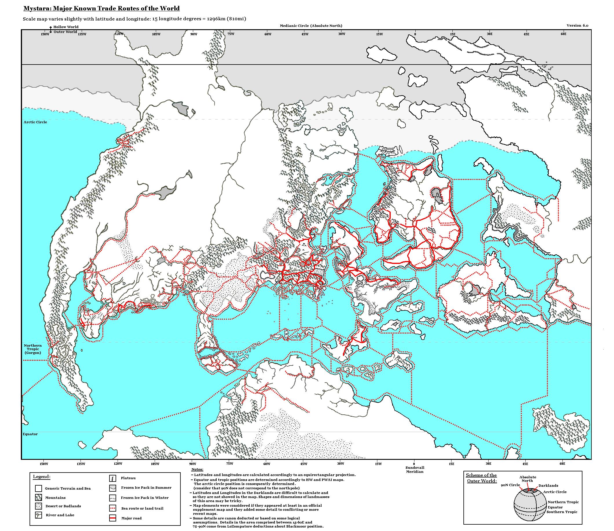
Please notice again that the Equator, Northern Tropic and Arctic Circle are not in the right position.
In my opinion we can infer a couple of things from these maps:
- Some of the so called "faraway" places such as the Thanegioth archipelago and the western Savage Coast seems to be thriving trade hubs for the nearby regions;
- The Known World is one of the most "civilised" region, in terms of trade connections; the same is true for central Isle of Dawn, northern Ochalea and SE Alphatia;
We could also determine or modify the Port Classes of most of the sea cities by counting the number of sea routes connecting the city to other destinations. The same might be done for land-based cities in order to state their importance as a mercantile hub.
Next step would be to list the major import/export of the various nations of these maps and see if there is some equivalent of the Silk or Spice Roads in Mystara. This is not a very easy task, anyway, but who knows...